RISING Student Poster Showcase Gallery
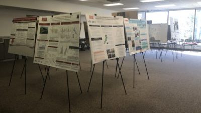

The Southeast Climate Adaptation Science Center, along with the Department of History at North Carolina State University, hosted a Student Showcase Poster Session in conjunction with our Global Change Seminar Series and the RISING NC exhibit grand opening on March 28, 2019. The Student Showcase Poster Session consisted of posters from students in a variety of backgrounds and also included participation from SE CASC Global Change Fellows (Dol Raj Chalise, Danielle Lawson, Zekun Lin, Mike Madden, and Andre Taylor)
The student posters highlighted an aspect of sea level rise and were developed from many disciplinary perspectives and backgrounds, framed around elements of science (physical, environmental, or social), impacts, or adaptation strategies relevant to sea level rise. The poster session and series was funded through a lightning rod grant from the College of Humanities and Social Sciences, titled, Rising Seas, Storms, and Rural Communities: The Politics, History and Place of Recovery and Resilience in the Coastal Plain.
Name: Dol Raj Chalise
Department: Civil, Construction and Environmental Engineering
Poster Title: Tropical storm contribution to seasonal streamflow in the southern United States
Description: Every year, tropical cyclone (TC) strikes coastal states of the Gulf of Mexico, the North-South Atlantic states, brings heavy rainfall on time scale of a few days, causes floods resulting in tremendous economic and property losses. Recent studies have focused on identifying the contribution of heavy rainfall associated with tropical cyclones in the south-eastern U.S. [toggle_box]
[toggle_item title=”READ MORE” active=”false”]However, no comprehensive study is available to characterize the contribution of TC to seasonal streamflow, in the southern US. This paper examines the fractional contribution of 71 TC-events to seasonal streamflow and annual maximum streamflow at 467 long-term U.S. Geological Survey (USGS) virgin streamgages with 20 years of daily discharge data from 1998 to 2017. The tropical system contributes on average 12% of the total seasonal (June to November) streamflow. For TCs making landfall, the tropical cyclone streamflow contribution could be locally up to 38% on monthly basis. The highest fractional contributions to annual daily maxima by these storms (>30%) are found in Florida and North Carolina. Nearly 70% of the streamflow gages experiences one annual maximum that was generated by TC event.[/toggle_item]
[/toggle_box]
 Name: Elizabeth Clark
Department: School of Architecture
Poster Title: Community Resilience by Design: Addressing the Social, Economic, and Environmental Needs of a Flood-Ravaged North Carolina Town by Celebrating its Assets
Description: North Carolina’s Edgecombe County, a patchwork of mostly small, insulated towns, currently leads the state in obesity, diabetes, heart disease, and resulting deaths. Princeville, the first town in the country to be settled and incorporated by freed slaves, is no exception. [toggle_box]
[toggle_item title=”READ MORE” active=”false”]Princeville, though it hosts a vivid community fabric, is a special case as it is suffers periodic flooding from the nearby Tar River, especially after 2016’s Hurricane Matthew, which has devastated much of the town’s infrastructure beyond repair. Consequential disinvestment in the town’s economy has forced residents, businesses, and even schools elsewhere, leaving Princeville fundamentally destitute. The proposed Princeville Community Produce Center was ideated through collaboration between designers and town residents, officials, and social authorities, aiming to become a hub of social, economic, health, educational, and cultural reinvestment. Such a center would primarily exist as a way for residents to grow, learn about, and purchase fresh produce, making healthier food part of the influential culture that underpins the town. This project also addresses the tangible site and next life of the historic Princeville Museum and Welcome Center as it evolves to serve modern needs and environmental conditions of Princeville. By holistically considering the many assets and needs that exist in a particular community, designers are better able to create bespoke, responsive projects that address as many needs as possible while celebrating and supporting assets.[/toggle_item]
[/toggle_box]
 Name: George Elvin
Department: School of Architecture
Poster Title: Resilient Building Framing System for Coastal Hazard Mitigation
Description: Over forty percent of the U.S. population lives in coastal counties. But coastal dwellings are the most vulnerable to hurricanes. Hurricane Katrina alone caused over $96 billion in damages and destroyed or rendered uninhabitable over 300,000 homes, the vast majority of them light wood frame structures. Forensic analysis showed that damage most frequently resulted from the numerous, weak connections required in light wood framing. [toggle_box]
[toggle_item title=”READ MORE” active=”false”]But concrete and steel are not cost-effective alternatives for most coastal buildings. Can light wood frame construction systems be combined with mass timber to create more hurricane-resistant buildings? This research project draws on the advantages of mass timber, pole construction, balloon framing, and light wood platform framing to create extremely rigid structures more resistant to hurricane forces than current light wood frame buildings. Scale-model testing of this system at North Carolina State University has begun, with full-scale testing to begin later this year.[/toggle_item]
[/toggle_box]
 Name: Jennifer Greig
Department: School of Architecture
Poster Title: Marsh House- Roanoke Island, NC
Description: The North Carolina Outer Banks are a dramatic and continuously changing environment. As a storm barrier for mainland North Carolina, these banks absorb fifty percent of incoming wave energy and can be dangerous sites for human habitation. The landscape is fluid and the winds are dynamic, making it a challenge to build responsively. The Marsh residency acts in conjunction to the surrounding marshland. [toggle_box]
[toggle_item title=”READ MORE” active=”false”]The house performs as an additional barrier against wind and waves, helping to sustain the neighboring natural banks. In severe weather, the house protects itself behind a shield of heavy cladding. When the storm passes, the house opens up to the surrounding marshland with its system of sliding doors and folding screens.[/toggle_item]
[/toggle_box]
 Name: Jenna Hartley
Department: Parks, Recreation, & Tourism Management
Poster Title: Intergenerational learning beyond the immediate family: are children environmental change-agents in their communities?
Description: This work examines the role of children in influencing adult attitudes and behaviors around the topic of marine debris, or plastics in the ocean. This work builds on K-12 STEM education with a curriculum designed for 4th and 5th grade students. it also includes a portion that is a call to civic action, to be completed by students in coastal counties and across the state of North Carolina.
 Name: Faith Johnson
Department: Civil, Construction, and Environmental Engineering
Poster Title: A Case Study in using Remote Sensing to Quantify Motu Morphometrics
Description: Motu (reef islands) are the inhabitable and populated sub-aerial land on an atoll. Atolls are low lying with mean elevations of 2-3 m. Atolls may be particularly vulnerable to climate change (including sea level rise, increasing ocean temperatures, and ocean acidification) because they are composed primarily of unconsolidated carbonate sediments eroded from reefs. Recent research has found that certain atolls may be resilient to climate change. [toggle_box]
[toggle_item title=”READ MORE” active=”false”]However, we lack comprehensive understanding about the primary processes driving motu evolution. Motu may self-organize and reach an equilibrium reef-at width in response to a particular wave climate suggesting that exterior forcings (wave climate) may be the primary control on motu evolution. For Katiu and Fakarava, French Polynesia, our case study, I created Landsat composites, categorized each component of the atoll (water, reef at, or motu), and calculated morphometrics (e.g. atoll size and shape, the width of the reef at, and the individual motu size and shape) using Google Earth Engine and Python. Local wave and storm climate will be compared to the calculated morphometrics. The methodology will be applied globally in the future in order to test if external forcings are the primary drivers of the evolution of atoll motu.[/toggle_item]
[/toggle_box]
 Name: Danielle Lawson
Department: Parks, Recreation, & Tourism Management
Poster: Adolescents as Climate Communicators: New Methods for Engaging Everyone in the Climate Change Conversation
Description: Climate change is arguably the most pressing environmental challenge of modern times (IPCC, 2014). Although technical solutions to mitigate climate change, such as subsurface water desalinization exist, the success of these approaches hinges on wide-spread societal support. Unfortunately however, political ideologies and worldviews render adults incapable of separating climate science fact from opinion, when forming perceptions. [toggle_box]
[toggle_item title=”READ MORE” active=”false”]Children however, unlike adults, appear to be less influenced by influences of political ideology and cultural worldviews, as these are still developing (Keating, 2004). Accordingly, children appear more capable of separating climate science fact from opinion (Stevenson et al., 2014), and may represent a promising yet understudied pathway to spurring responses to climate change. Research from diverse fields demonstrates that children are capable of influencing the knowledge, attitudes, and behaviors of the adults in their lives through a process called intergenerational learning (IGL) (Bottery, 2016) (e.g., shifting parental views on sexual orientation [LaSala, 2000]). As such, we propose that IGL-based climate communication strategies make use of a communication pathway robust to personal ideologies and worldviews, and accordingly may be a successful strategy in building the political will to adequately address climate change. To test the efficacy of IGL-based communication strategies, we conducted a two-year case study in coastal North Carolina with 15 middle school science teachers. Results showed that children’s increases in climate concern predicted parent increases in climate concern as a function of presence in a treatment classroom. This was particularly prominent in those parents who identified as conservative, male, or had daughters. These results suggest that children may indeed be a unique vector to promoting climate change concern and behaviors in adults through IGL.[/toggle_item]
[/toggle_box]
 Name: Cindy Lebrasse
Department: Marine, Earth and Atmospheric Sciences
Poster Title: Effect of water circulation on dissolved organic matter dynamics and export in Bald Head Creek, NC
Description: My poster talks about the importance of salt marshes as valuable sinks for atmospheric carbon dioxide, and how water circulation, in terms of tidal inundation, influences the export of organic carbon from the salt marshes into the adjacent waters. This relates to how sea-level rise could affect the carbon storage capacity of salt marshes, shifting these systems from carbon sinks to carbon sources to the atmosphere.
 Name: Zekun Lin
Department: Geospatial Analytics
Poster Title: Simulating Population Growth and Urbanization Patterns under the Impact of Sea Level Rise at Southeastern North Carolina
Description: Cities have the endogenous attraction to residents due to more comprehensive infrastructures, better economic opportunities.However, as global sea level rise (SLR) becomes a major concern, coastal residential areas are exposed to the risks of turning into permanent inhospitable lands. Such risks become one of the exogenous reasons for introducing differences in population growth and migration patterns between coastal and inland areas. [toggle_box]
[toggle_item title=”READ MORE” active=”false”]The available land areas for urbanization thus got limited by the inundate possibility. In addition, people will avoid risky areas when pick their potential destination of migration. Simulating the urban growth and population migration in such condition will help resource managers and decision makers to visualize and project the urbanization and population movement at the specific regions. This project proposes to simulate and compare urbanization patterns at selected counties at the Southeastern North Carolina with the risk of sea level rise under three scenarios: 1) normal urban growth pattern without considering sea level rise; 2) urban growth with restricted available grid cells for urbanization at coastal regions, but people’s desirability will stay the same as scenario 1; 3) the grid cells are restricted, and people’s desirability to live in risky coastal areas changes as a function of the distance to the potential inundate area.[/toggle_item]
[/toggle_box]
 Name: Mike Madden
Department: Marine, Earth, and Atmospheric Sciences
Poster Title: How Does Climate Change Increase the Severity of a Flood-Producing Rain Event in the U.S. Southeast?
Description: In this case study, we will analyze the effects of rising temperatures on a local heavy rain event. We will show that introducing the effects of climate change will cause heavier rainfall through the intensification of storm dynamics. The intensification of storms with rising temperatures is a worrisome trend, as it introduces challenges to future city planning, infrastructure design, and public safety.
 Name: Melinda Martinez
Department: Forestry and Environmental Resources
Poster Title: Detecting Early-Warning Signals of Forested Wetland Retreat
Description: The southeastern US coastline has seen an increase in extensive tree mortality (i.e. ghost forests) due to climate change variability and human activities. Ghost forests are areas that were healthy forested wetlands in the past, but are now transitioning to marshes or open water. Critical transitions occur when ecosystems become increasingly fragile to disturbances, to the point where a small perturbation may trigger a change to a new state. [toggle_box]
[toggle_item title=”READ MORE” active=”false”]As freshwater forested wetlands transition to other wetland types, the ecosystem services provided become reduced or altered. Given the potential loss of ecosystem services, it is important to anticipate when and where critical transitions are likely to occur, but it has been challenging to map these transitions, which has limited mitigation efforts. Anticipating these transitions will lead to better predictive models by revealing the causal factors and processes, and open windows of opportunities for managers to prevent the loss of ecosystem services.[/toggle_item]
[/toggle_box]
 Name: Lise Montefiore
Department: Biological and Agricultural Engineering
Poster Title: Identifying estuaries at-risk of eutrophication under future climate and land use change scenarios in the Southeast United States
Description: Estuaries are highly productive ecosystems that face critical threats from local (e.g., population growth, land use) and global (e.g., sea level rise, climate change) pressures. In the near-term, freshwater inputs could potentially impact estuarine systems by affecting their nutrient loads and salinity regimes. [toggle_box]
[toggle_item title=”READ MORE” active=”false”]The present work seeks to predict the extent to which estuarine systems will be exposed to changes in freshwater runoff by 2050 that could result in eutrophication. Specifically, we focused on the Gulf of Mexico and South Atlantic due to the economic and ecologic importance of estuaries in this region, and estimated future change in freshwater quality across all HUC6 coastal basins of the Southeast United States that drain to estuaries. To identify estuarine systems at highest risk of freshwater-driven change, climate and LULC projections under two scenarios (RCP 4.5 and RCP 8.5) were compiled for this region and used to evaluate the likelihood of increased nutrient loading and eutrophication.[/toggle_item]
[/toggle_box]
 Name: Justine Neville
Department: Forestry and Environmental Resources
Poster Title: Hydrometeorological Variables as Drivers of Episodic Saltwater Intrusion in Freshwater Dependent Coastal Landscapes
Description: In the coastal plain of NC, episodic saltwater intrusion along natural and artificial surface water drainages can have serious ecological impacts, including forest die off and loss of freshwater-dependent coastal wetlands. Prior studies have modeled the movement of saltwater intrusion and estimated salt fluxes in tidally influenced rivers and estuaries, but little work has focused on episodic saltwater intrusion along natural and artificial drainages in low-lying coastal landscapes. [toggle_box]
[toggle_item title=”READ MORE” active=”false”]Here we investigate the indicators of episodic saltwater intrusion events observed in specific conductance time series from a network of surface water monitoring stations in coastal North Carolina. We combine specific conductance with other hydrological and meteorological variables to identify some of the mechanisms driving saltwater intrusion events in this region. We evaluate the role of moisture on the landscape and how it pertains to temporal changes in surface water salinity.[/toggle_item]
[/toggle_box]
 Name: Kathryn Rende
Department: Learning and Teaching STEM
Poster Title: Investigating Online Open Forums As Educational Spaces For Hazards Literacy Learning
Description: The ability to accurately interpret graphical probabilistic information is a significant factor that influences public decision-making about the risks associated with environmental hazards like hurricanes, coastal flooding, and sea level rise. However, many scientific and technical images are easily misunderstood and misinterpretations can be subsequently re-communicated in social and educational settings. [toggle_box]
[toggle_item title=”READ MORE” active=”false”]In this study, qualitative interviews and a content analysis within the online open forum Reddit were conducted to explore visual discourse of information shared before the landfall of Hurricane Florence in September 2018. Results are consistent with previous research regarding the reliability of certain types of hazard- related imagery and the correlation between type of image referenced and potential for misinterpretation. It also further establishes online social learning platforms as spaces where environmental hazards literacy can be learned. These findings yield information about the role online social learning environments like Reddit play in facilitating hazards and hazard-related image literacy learning for youth and adults, and situates Reddit and other online open forums as viable learning spaces in which future education-based research can take place.[/toggle_item]
[/toggle_box]
 Name: Lindsey Smart
Department: Geospatial Analytics
Poster Title: Mapping Coastal Biomass Declines from Sea Level Rise on the Albemarle-Pamlico Peninsula in NC
Description: Despite their limited global extent, low-lying coastal forests play a key role in carbon capture and retention. Sea level rise and the salinization of freshwater ecosystems pose a growing risk to the health and survival of coastal forests, affecting their continued ability to serve as carbon sinks. In this study, we quantify changes in aboveground biomass over a 13-year period (2001-2014) in a structurally complex coastal vegetated environment on the Albemarle-Pamlico Peninsula in North Carolina. [toggle_box]
[toggle_item title=”READ MORE” active=”false”]We integrated field measurements of tree height and biomass with repeat lidar surveys and multi-spectral Landsat imagery to estimate the magnitude and spatial patterns of aboveground biomass change. Results from our research can be used to identify the landward extent of sea level rise impacts, a particularly salient topic in this era of rapid environmental change.[/toggle_item]
[/toggle_box]
 Name: Andre Taylor
Department: Public History
Poster Title: Stay: How are the Gullah/Geechee people of South Carolina preserving their culture by adapting to climate change?
Description: This poster features original research that focuses on the collection of oral histories of the Gullah/Geechee people in the Sea Islands of South Carolina who are impacted by sea level rise and climate change. The purpose of the research is to gather oral histories and climate data to develop a narrative around how and also why have the Gullah/Geechee community in the Sea Islands decided to adapt in the face of climate change, displacement and sea level rise?
Name: Olivia Vila
Department: Parks, Recreation, and Tourism Management
Poster Title: Environmental Justice and Recovery: Citizen Science in the Post-Disaster Context
Description: When recent hurricanes hit North Carolina, there were explicit concerns over CAFO waste lagoons flooding, breaching, or overtopping as a result of heavy rainfall and ultimately making its way into public or residential areas. As with many environmental justice or contested illness issues, individuals may express certain concerns but there is no way to verify the information. [toggle_box]
[toggle_item title=”READ MORE” active=”false”]This poster is based on a Quick-Response Citizen Science project attempting empower Lumberton, NC residents with tools that can help them better understand the landscape they live post-disaster. Residents are trained to collect their soil samples (analyzed for E. coli) and are interviewed before and after soil results are delivered. This project will yield results that provide residents baseline data regarding E. coli presence in their residential soil and provide information as to whether the engagement process raises awareness of environmental disaster risk and empowers residents to advocate for more appropriate recovery resources.[/toggle_item]
[/toggle_box]
 Name: Zhenzhen Zhang
Department: Forestry and Environmental Resources
Poster Title: Combining social vulnerability and flood hazard mapping for risk assessment
Description: The impacts of flooding are increasing with global change, but are unevenly distributed across communities. Community vulnerability is affected by socio-economic status as poorer, more diverse communities are more likely to be exposed to flood risk. This research is identifying community risks to large storm events such as Hurricanes Matthew and Florence by combining flood hazard mapping and social vulnerability. [toggle_box]
[toggle_item title=”READ MORE” active=”false”]This research focuses on Robeson County, located in the Coastal Plain of NC. The county includes a high percentage of minority and low-income residents and is home of the Lumbee Tribe. This study is using an advanced deep learning techniques, Convolutional Neural Network to build the relationship between flood risk and biophysical conditions. The risk map is be combined with social vulnerability index to identify area where risk assessment should be prioritized.[/toggle_item]
[/toggle_box]
- Categories: