2020 Drought Conditions in the U.S. Caribbean
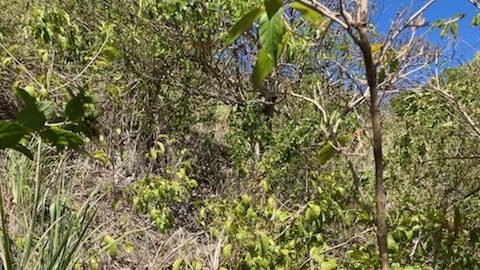
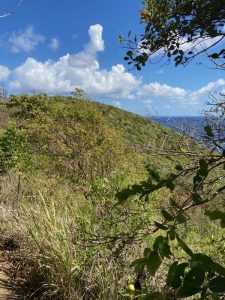
The U.S. Caribbean region encompasses the commonwealth of Puerto Rico and the territory of the U.S. Virgin Islands (USVI), and are part of footprint of the Southeast CASC. The USVI, comprising the islands of St. Croix, St. John, and St. Thomas, has been experiencing an extreme drought this summer, resulting in extensive impacts on ecosystems and communities.
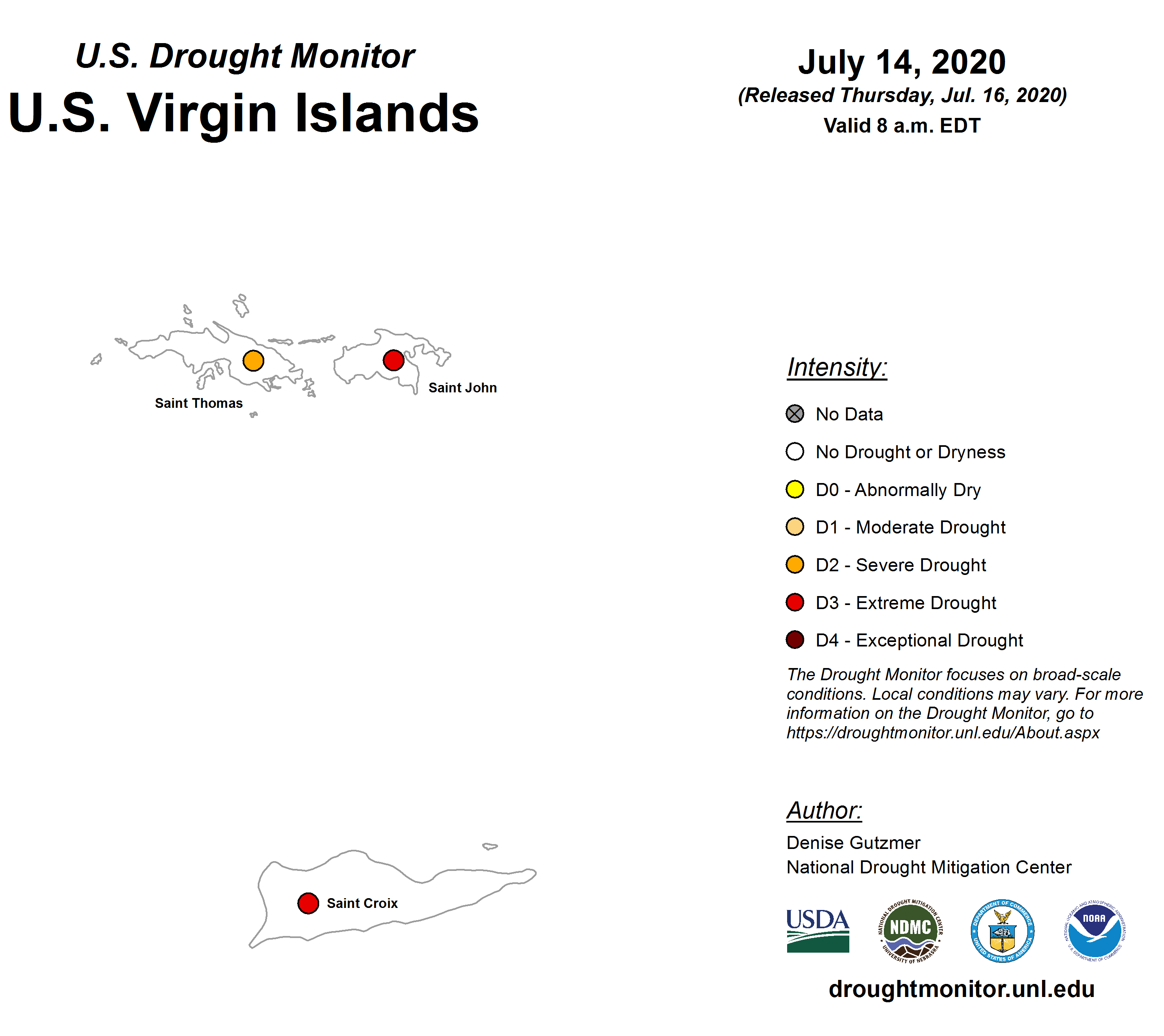
As of July 14, 2020, the island of St. Thomas is faced with a “severe drought” while the islands of St. John and St. Croix are experiencing an “extreme drought,” according to the U.S. Drought Monitor. On the island of St. Croix, the total year-to-date rainfall is 8.68 inches, about 3.2 inches below normal. On the islands of St. Thomas and St. John, monthly rainfall in the month of May was about an inch below normal.
The impacts of severe drought classified as level “D2” by the U.S. Drought Monitor include: planting being delayed, the agriculture sector suffering, trees and plants showing stress, and strict water rations being implemented. At a level “D3,” or severe, drought which is currently facing the islands of St. John and St. Croix, these impacts are heightened to include: cattle having little feed, crops dying, daily lives being altered, businesses closing, mosquito-borne disease outbreaks becoming possible, tree phenology changing, expanding water rationing, water needing to be trucked in, and shrinking aquifers.
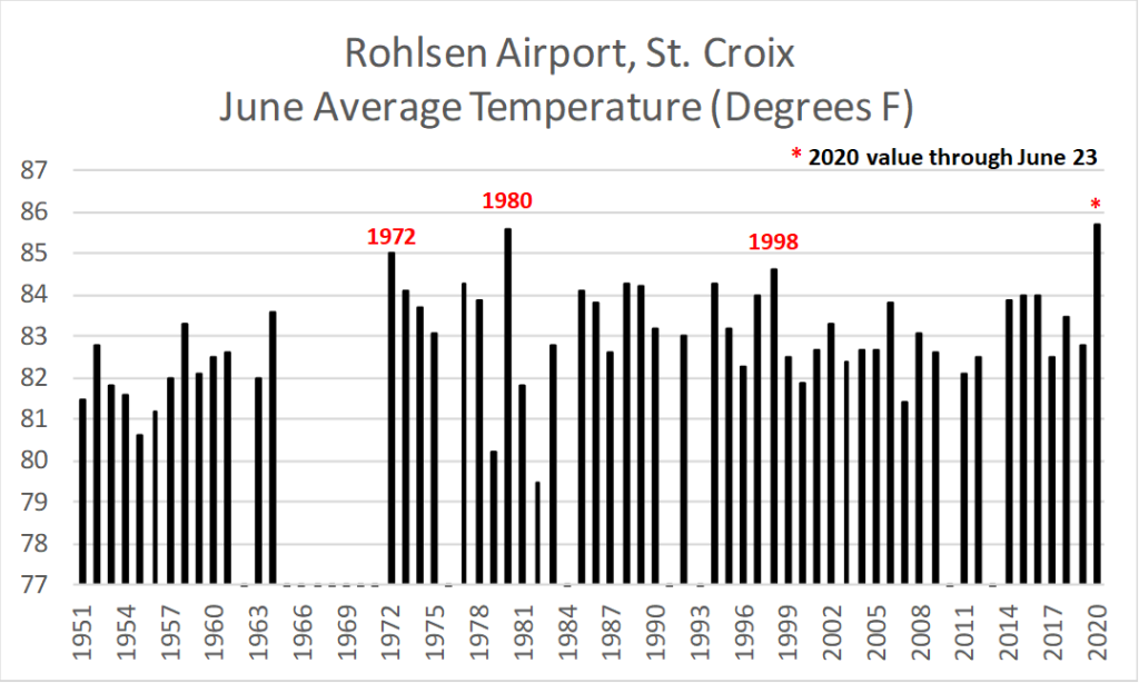
USDA meteorologist Brad Rippey maintains weather data for the U.S. Virgin Islands and states that St. Croix is on on track to experience the hottest June since 1980 due not only to the lack of rainfall, but also increasingly high temperatures. The graph below shows that through June 23, the month-to-date average temperature of 85.7 degrees F is 2.9 degrees above the 1981-2010 normal value and slightly above the current (1980) record of 85.6 degrees.
The USVI was officially added to the U.S. Drought Monitor on June 6, 2019 in the midst of the prolonged drought that was experienced last summer. This addition to the drought monitor was long awaited. In response to the detrimental impacts from the 2015 drought in the USVI, the USDA and the National Drought Mitigation Center, in partnership with the University of the Virgin Islands, the VI Dept. of Agriculture, VITEMA, and the National Weather Service held a forum to discuss how to get the USVI on the drought monitor map so the region could receive additional drought relief resources. In the USVI, each of the three islands are mapped separately. This data collection provides a reliable system to more quickly and easily prove that the region is in a drought and in need of additional resources. This measurement data allows for the Department of Agriculture to apply for the Livestock Forage Disaster Program, which provides aid to farmers who have been affected by the drought.
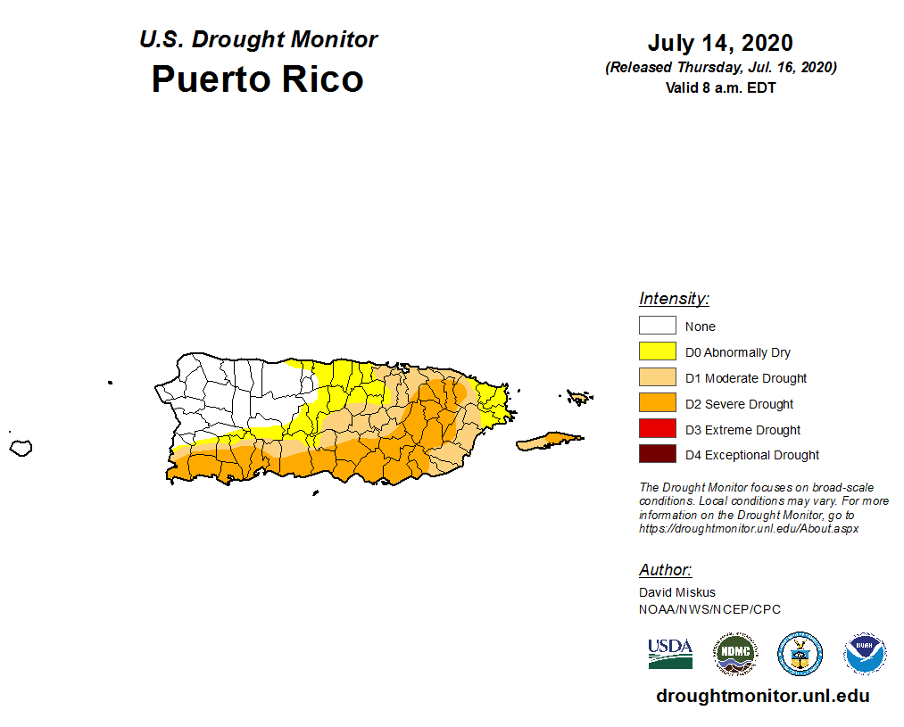
Puerto Rico has also been affected by high temperatures and lack of rainfall, as the region is experiencing abnormally dry conditions to moderate/severe drought across most of the island. About 60% of Puerto Rico is experiencing these drought conditions, prompting Governer Wanda Vázquez to declare a state of emergency for the region on June 30. There are an estimated 2,401,328 residents of Puerto Rico currently living in a drought area and on July 2nd, Puerto Rico’s water utility company began rationing access to water for 140,000 clients.
Unfortunately, these conditions have become more common in the USVI and Puerto Rico over recent years. The 2015 drought mentioned earlier created turmoil for the agriculture sector in the Caribbean by damaging crops, weakening and killing livestock, and increasing the threat of wildfires. During the summer of 2018, the National and Southeast Climate Adaptation Science Centers sponsored a workshop in San Juan, Puerto Rico, in conjunction with USDA Caribbean Climate Hub and other partners, to discuss the impacts of drought on ecosystems, agriculture, and water supply in the U.S. Caribbean, as well as data needs and potential future research directions.
During the workshop, the oral histories of resource managers attending the drought workshop were recorded as part of the Caribbean Oral History project. These stories explain first-hand the lived experiences of these island residents, providing lessons learned from the past and solutions for the future. From stories of extreme storms like Hurricanes Irma and Maria to slower-moving chronic issues like drought and how they impact communities and ecosystems, these stories provide insight into the information needs of the natural resource community in Puerto Rico and the U.S. Virgin Islands. These accounts help us to learn what types of research could help managers effectively plan for future extreme weather events. You can learn more about the workshop and listen to the stories of the participants here.
- Categories: