New Tools: Mapping the Status and Benefits of Natural and Working Lands in North Carolina
SE CASC Consortium researchers, Katie Warnell and Lydia Olander have developed several products that summarize and visualize data and analyses of the status and benefits of natural and working lands – forests, farmlands, and wetlands – in North Carolina, work that contributed to climate risk assessment and resilience planning efforts of the state. The following post was originally published on the website of the Nicholas School of Environmental Policy Solutions and can be viewed here.
 Duke-Designed Dashboards Map Benefits of NC’s Natural and Working Lands
Duke University researchers have launched a series of tools that put the benefits of North Carolina’s forests, farmlands, and wetlands on the map.
Duke’s Nicholas Institute for Environmental Policy Solutions has developed three online dashboards that make detailed data about these natural and working lands easily accessible to communities, land managers, non-governmental organizations, and the general public. An accompanying story map introduces concepts and terms used in the dashboards, explains how to use them effectively, and highlights key findings.
“The dashboards will put information about the status and benefits of North Carolina’s natural and working lands at users’ fingertips,” said Katie Warnell, policy associate for the Nicholas Institute’s Ecosystem Services Program. “This information can help landowners and decision makers with management and planning processes.”
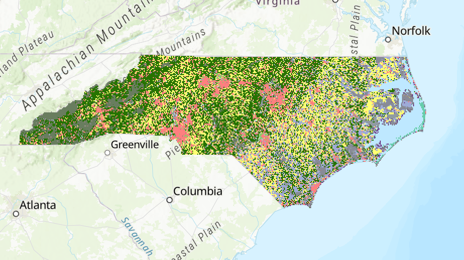
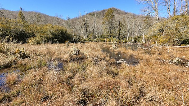
Natural and working lands cover more than 80 percent of North Carolina. They benefit the state’s people and economy in a variety of ways: protecting water quality and supply, reducing flood risk, providing habitat for pollinators, and much more. These lands—particularly forests—also store carbon in their soils and vegetation, helping to offset greenhouse gas emissions that cause climate change.
The dashboards allow users to quickly see these benefits by county, river basin, or land type:
- Overview Dashboard – General information about the area and benefits of natural and working lands
- Conservation Dashboard – Focus on natural and working lands that are protected for conservation purposes
- Carbon Dashboard – Details about past, current, and potential carbon storage by land type
The dashboards synthesize a wide range of data that informed recent state planning efforts recognizing the importance of natural and working lands. Those plans include the 2020 Natural and Working Lands Action Plan (part of the NC Climate Risk Assessment and Resilience Plan) and the draft Coastal Habitat Protection Plan 2021 Amendment. Collectively, the plans are helping to quantify the benefits that North Carolinians currently get from natural and working lands. They also explore additional benefits that could be gained through management actions, such as reforestation or agricultural best management practices.
While the dashboards can provide users with detailed information down to the smallest county or river basin, the story map highlights some noteworthy statewide results:
- Less than 20 percent of North Carolina’s natural and working lands are conserved, leaving them vulnerable to degradation or development. Between 2001 and 2019, more than 600,000 acres were converted to another use.
- While most of North Carolina’s conserved land is under state or federal ownership, more than half a million acres of conservation land are privately owned.
- Reforestation offers some of the best opportunities to increase carbon storage on natural and working lands. Improved agricultural management practices, such as use of cover crops, would also provide carbon benefits.
The Nicholas Institute team views the dashboards as a first step to tracking how the status and benefits of North Carolina’s natural and working lands change over time. Seeing longer-term trends could improve understanding about how land use and management decisions affect the critical benefits that natural and working lands provide.
The information in the dashboards can also be useful for identifying areas for future conservation work. For example, the Nicholas Institute is beginning a new project in collaboration with Conservation Trust for North Carolina to develop a prioritization tool and benefits calculator for North Carolina land trusts and state agencies that manage land.
The NC Natural and Working Lands Dashboards were developed by Warnell; Shouta Hayashi and Sasha Keller, who are pursuing master of environmental management degrees at Duke’s Nicholas School of the Environment; and Lydia Olander, director of the Nicholas Institute’s Ecosystem Services Program. Funding was provided by the U.S. Department of the Interior Southeast Climate Adaptation Science Center (Grant No. G17AC00204 from the U.S. Geological Survey).
- Categories: