Southeast CASC Initiates New Actionable Science Projects
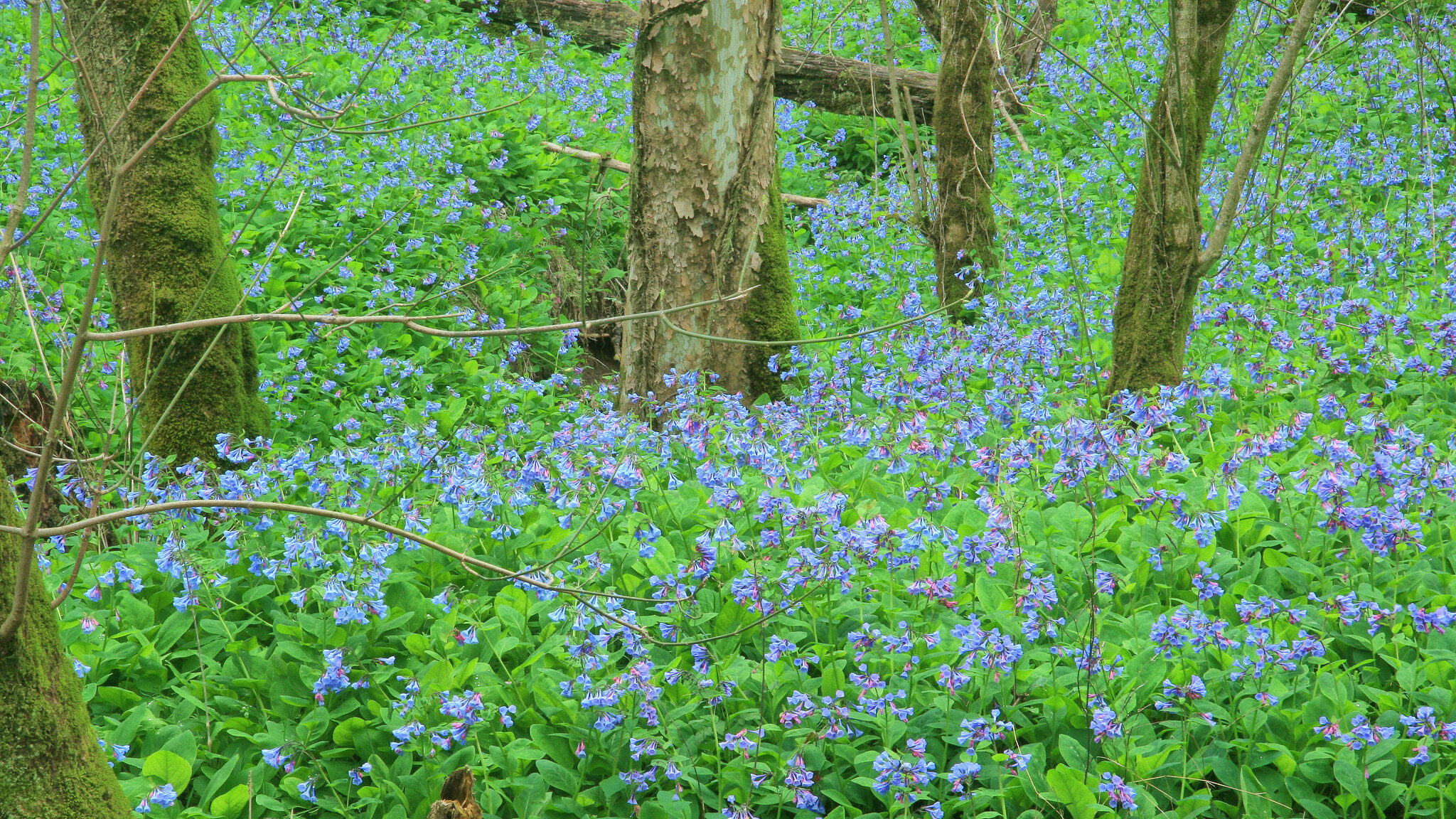
Research funded by the Southeast Climate Adaptation Science Center encompasses a range of science activities that contribute to understanding the exposure and impacts of global change on resources that matter to our partners and to framing decisions about adaptation strategies, emphasizing principles of co-produced actionable science. We’re pleased to announce six newly initiated actionable science projects. Learn more about them below, and learn about progress and products from these and other SE CASC projects on our Science page.
Improving Support for Regional Conservation Efforts in the Region Managed by the Southeastern Association of Fish and Wildlife Agencies
Principal Investigator: Nils Peterson, NCSU
Proposed Project Completion: July 2023
Implements Science Plan Theme: Adaptation
Co-Investigators: Lincoln Larson, Kathryn Stevenson, Erin Seekamp, NC State University; Mallory Martin, Louise Vaughn, US Fish and Wildlife Service; Paul Armsworth, University of Tennessee – Knoxville
Project Overview: States in the Southeastern Association of Fish and Wildlife Agencies (SEAFWA) region have faced challenges when trying to develop regional plans or actions for many conservation issues. Leadership in many SEAFWA states is hesitant to approach the topic of climate change at all, let alone engage in multi-state efforts to mitigate climate impacts. Recent Southeast Climate Adaptation Science Center (SE CASC) supported research surveyed agency directors and supervisory boards, and discovered their primary concerns revolved around agency budgets, “R3” efforts (i.e., to recruit, retain, and reactivate hunters and anglers), and public outreach to maintain social relevance. Another project supported by the SE CASC and the Southeast Conservation Adaptation Strategy (SECAS) involved interviewing SECAS participants, and suggested they value the SECAS partnership as an information hub, particularly regarding the Southeast Conservation Blueprint. The SE CASC – SECAS study importantly highlighted a need for SECAS participants to better engage state agency leadership and field biologists working for wildlife agencies in SECAS states.
This project proposes to address the primary gap in knowledge around viability of regional responses to wildlife conservation initiatives by surveying state agency leadership (at the division chief level) and field biologists from across the SEAFWA states. The research team will address three questions. First, this project will measure which elements of wildlife conservation respondents are willing to engage in at a regional level, and how much they are willing to push for a regional response for each element. Second, this project will ask respondents what assistance is most valuable for developing regional responses. Third, this project will ask participants to list perceived costs (e.g., interfering with long term data collection for indices) and benefits (e.g., leveraging resources across state borders) associated with regional planning for each element.
Integrating Sea Level Rise Scenarios into Everglades Restoration Planning
Principal Investigator: Laura D’Acunto, USGS Wetland and Aquatic Research Center
Proposed Project Completion: September 2023
Implements Science Plan Theme: Impacts
Co-Investigator: Stephanie Romañach, US Geological Survey
Project Overview: One of the largest and most expensive restoration efforts in the world is the restoration of the Everglades, a sub-tropical freshwater wetland system located in southern Florida. This unique ecosystem supports several endemic and endangered species, provides flood control for Florida’s large urban population, and provides water for both the agricultural and drinking supply within the state. The Comprehensive Everglades Restoration Plan (CERP), authorized by Congress in 2000, guides federal, state, and local efforts to build the infrastructure necessary to bring more water into the Everglades and restore its ecological integrity.
The Everglades flows into the southern coast of Florida and restoration efforts are likely to be impacted by climate induced sea level rise. However, many current project planning studies do not incorporate the potential impact of sea level rise in restoration plan evaluations. Resource managers and project planners require methods and tools to confidently incorporate scenarios of sea level rise into their evaluations. This project will work with stakeholders from multiple agencies to:
- identify the restoration questions that need to consider sea level rise,
- provide information on how to choose scenarios most relevant to each unique project, and
- provide the methodology to incorporate chosen sea level rise scenarios into the current planning processes through ecological models.
Incorporating sea level rise scenarios into Everglades restoration project planning will better determine whether projects will maintain or improve the Everglades’ ecological integrity. Stakeholders can use the tools developed by this project to improve their ability to decide between competing restoration plans as CERP projects continue to be implemented across the landscape.
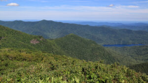
Informing Climate-adaptive Forest Management for Breeding Bird Habitat in the Southern Appalachians
Principal Investigator: Robert Scheller, North Carolina State University
Proposed Project Completion: December 2023
Implements Science Plan Theme: Adaptation
Co-Investigators: Samuel Flake, North Carolina State University; Tina Mozelewski, University of Massachusetts-Amherst
Project Overview: The populations of many forest birds have declined in recent decades due to loss of habitat area and degradation of habitat quality. Past land management has left the landscape of the heavily forested Appalachian Mountains with too little old growth as well as too few young, regenerating forests. This change in habitat structure has led to the listing of several forest birds as Species of Greatest Conservation Need. Active management is needed to maintain habitat for these species, but climate change may alter the kinds of management that are effective.
Climate change is likely to affect forest structure – and bird habitat suitability – because of shifts in temperature, precipitation, and disturbance. While current management plans recognize climate change as a threat to some species, long-term planning is limited by uncertainty in how climate change will affect threatened bird species and what options are most likely to be effective in adapting management plans to future climate.
The research team will co-design management scenarios with partners and stakeholders. A simulation model of forest dynamics coupled with models of bird habitat will be used to assess the potential for these strategies to maintain bird habitat into the future. In close collaboration with partners, the research team will develop forecasts for priority bird conservation areas and maps of bird habitat under several co-developed management scenarios and climate projections. These forecasts and maps will allow partners to improve their long-term planning by estimating direct and indirect threats to birds under climate change, quantifying the potential for interventions to mitigate those threats, and identifying areas to prioritize for management. The improved planning aided by these decision-support products will improve long-term outcomes of management projects while predicting and reducing conflicts with other management goals.
Water, Water Everywhere: Adapting Water Control Operations and Floodplain Conservation Planning to Global Change
Principal Investigator: Simeon Yurek, U.S. Geological Survey
Proposed Project Completion: May 2024
Implements Science Plan Theme: Adaptation
Co-Investigators: Julie DeMeester, The Nature Conservancy; Charlie Stillwell, USGS South Atlantic Water Science Center; Barbara Doll, NCSU; Jack Kurki-Fox, NCSU; Danica Schaffer-Smith, The Nature Conservancy; Wilson Laney, NCSU; Mitch Eaton, USGS; Chuck Peoples, The Nature Conservancy; Brian Boutin, The Nature Conservancy
Project Overview: Global change processes are producing shifts in temperature, precipitation, and seasonal streamflow regimes across North America. Much of the floodplain hydrology in the U.S. is managed through water control operations, often implemented on short time scales (e.g., weekly decisions), in response to short-term changes in precipitation. This operational model does not account for potential long-term trends, such as increased recurrence or shifts in seasonal timing of high flow events within a year. Therefore, polices that only focus on short-time scales and recent historic conditions may not perform as well under altered climate regimes.
This uncertainty in future floodplain conditions is concerning for a variety of environmental resource managers. Managers of floodplain forests are concerned with maintaining sufficient flooding to redistribute sediments. Fish and wildlife managers are concerned with maintaining sufficient habitat connectivity during important fish spawning periods. Finally, conservation managers are concerned with where to establish reserve lands or implement restorations to optimize connectivity of fish and wildlife migratory corridors.
To address these concerns, the U.S. Army Corps of Engineers’ Sustainable Rivers Program (SRP) was developed to determine actionable strategies at reservoirs for improving river ecology throughout the country. The overall goal of the SRP is to maximize ecological benefits while maintaining authorized purposes of the infrastructure. In North Carolina specifically, the Nature Conservancy (TNC) and partners invest in restorations that target aquatic connectivity and are concerned with providing a high value of ecosystems services far into the future.
This project will examine an ongoing collaboration in North Carolina’s Roanoke River basin, a flagship example of conservation in action. Using the Roanoke watershed as a case study, the project team will develop transferable products that can be adapted and applied across river basins. Quantitative, scenario-based modeling will be developed using existing, publicly available models that are commonly specified for reservoirs, to assess ongoing climate change, as well as key impacts, uncertainties, and risk to stakeholder values. These climate change projections will greatly benefit management decision making and support environmental management initiatives such as land acquisition, land management, and restoration work and water management, as well as support the National SRP process. The proposed work will analyze climate change impacts at the Roanoke reservoir through 2099, connect those findings to floodplain and fisheries health, and aim to help the Nature Conservancy (and other landowners) and the SRP manage their resources.
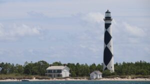
Examining Diverse Management Objectives and Broadening Stakeholder Engagement for Climate Adaptation Planning of Historic Structures Within the National Park System
Principal Investigator: Erin Seekamp, North Carolina State University
Proposed Project Completion: August 2024
Implements Science Plan Theme: Adaptation
Co-Investigators: Xiao Xiao, Arizona State University; Mitchell Eaton, USGS Southeast Climate Adaptation Science Center
Project Overview: This project seeks to enhance the stewardship of historic buildings vulnerable to climate change impacts. As sea level rise and storm-related flooding and erosion threaten our nation’s cultural heritage, there is a critical need to ensure that climate change adaptation decisions, including what cultural resources will be “let go”, are transparent and informed by the opinion of people whose heritage is tied to those resources. This project aims to enhance an existing decision support framework that supports adaptation planning by the National Park Service at coastal parks. The researchers of this project will focus particularly on Cape Lookout National Seashore.
The current decision support framework, called the Optimal Preservation (OptiPres) Model, enables managers to consider complex tradeoffs during a 30-year planning period under different annual budget scenarios. However, the OptiPres Model is currently limited in that it only addresses one management objective; maximizing the resource value of buildings retained across the 30-year planning period. However, multiple management objectives drive decision making (for example, visitor safety and enjoyment and cost efficiency). This project will include ongoing engagement with partner organizations affiliated with two historic districts listed on the National Register of Historic Places, as well as the North Carolina Historic Preservation Office staff and National Park Service staff. The goal of this engagement is to broaden the inclusion of invested people’s values and preferences into the OptiPres Model.
In addition, integration of different climate change effects, associated damage to historic buildings, and different strategies for recovery and adaptation into the OptiPres Model, will enhance the model’s utility and help to identify adaptation actions for historical structures to “best” prepare and recover from climate extreme events. Project results will enhance National Park Service managers’ understanding of the complex tradeoffs that need to be made when funding for adaptation is limited.
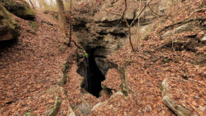
Developing a Cave Conservation Management Toolbox by Exploring Cave Microclimates and Biodiversity Patterns
Principal Investigator: Skylar Hopkins, North Carolina State University
Proposed Project Completion: July 2024
Implements Science Plan Theme: Adaptation
Co-Investigator: Matt Niemiller, University of Alabama in Huntsville
Project Overview: The southeastern United States has vast underground ecosystems where temperatures vary little throughout the year and humidity is always near 100%. These cave and karst ecosystems provide many services to people, such as recreational opportunities, revenue from tourism, and groundwater storage. Caves also provide habitats for important and endangered species, like bats that eat mosquitoes and crop pests.
Cave-dwelling species have evolved to live in relatively stable climates, so they may be especially sensitive to climate change. However, it is unclear how surface climate change will affect cave climates and the species that rely on them, because caves are remote environments that have long been difficult to study. This project will fill these important data gaps so that cave managers and scientists can better predict how management decisions will affect future cave ecosystems in a warming world with altered precipitation patterns.
The project will bring together scientists and managers from federal, state, and non-governmental organizations across nine southeastern states to perform underground surveys of cave climates and cave-dwelling species. Based on these surveys, they will identify any caves that contain rare species and any caves that are especially cool and wet. Forests could help keep caves cool and wet as global surface climates change, creating important refuges for species stressed by climate change. This project will also measure how much cave climates vary between caves under dense forests and caves under lands where forests have been removed. Using insights from new surveys and previously published studies, the team will create a toolbox of possible management actions for conserving cave ecosystems and cave-dwelling species threatened by climate change. The toolbox can be used by managers through the Southeast and the world when making decisions about how to conserve caves for future generations.
- Categories: