January 12, 11am ET: SE CASC Science Seminar – Facilitating Accurate and Effective Application of Coastal Marsh Models
Join us for our Fall/Winter virtual science seminar series highlighting SE CASC funded projects supporting resource management actions across the Southeast. Each month a SE CASC researcher will provide an overview of their work and the management implications of their research findings.
Learn about others in the Fall/Winter 2022 Seminar Series
Facilitating Accurate and Effective Application of Coastal Marsh Models
Renee Collini (PLACE:SLR), Trevor Meckley (NOAA NCCOS), and Christine Buckel (NOAA NCCOS)
January 12, 2023 | 11AM ET
View a recording of the webinar
Links shared during the webinar:
Webinar Overview:
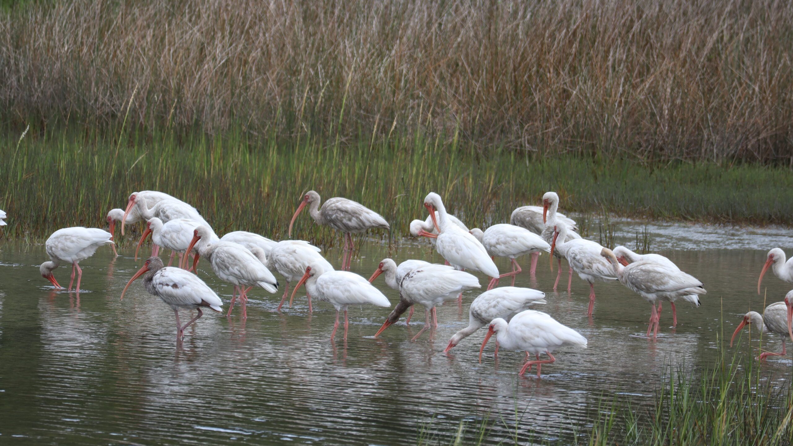
Salt marshes are integral to coastal communities, providing habitat for important species, such as shrimp and fish, and reducing the frequency and intensity of flood impacts on our homes and businesses. As sea levels continue to rise it is important that we understand how the health and extent of these marshes is expected to change so we know what actions we can take to maintain their critical function. There are many models that have been developed to characterize how marshes may respond to rising seas, each with a different approach and focus. As with any emerging scientific field, it is important to assess if the models’ predictions reflect what we observe; however, only recently have we had the ability to do that with marsh models because we lacked the detailed observations that were required.
We convened the leading marsh modelers from around the U.S. to devise a scientifically robust method for conducting a retrospective analysis. A retrospective analysis is where all the models are run with the same input information and from the same starting year from the past and the outputs are analyzed to see if they reflect what marshes look like today. It took a whole workshop and a team of modelers to devise an approach because each model is different, with different requirements for what needs to be put into the model and how the model produces its results. With this workshop we were able to devise a plan that worked for all the models and build buy-in to the processes among the modeling community. With this plan in place we are now able to perform the essential step of conducting the retrospective analysis so that we can understand which models work best in which coastal systems and for answering which management questions.
More About the Speakers:
Renee Collini (PLACE Program Coordinator):
Renee has a dual appointment as a Coastal Climate Resilience Specialist with Mississippi State University and Sea Grant. Focused on sea-level rise, Renee facilitates the flow of information between researchers and decision-makers to improve science application. The lead of the Program for Local Adaptation to Climate Effects: Sea-Level Rise, she integrates a multi-state network of stakeholders, researchers, NGOs, and state and federal agencies to build tools, programs, and projects to address gaps in sea-level rise observing, research, and decision-making in the northern Gulf of Mexico. She has collaborated on projects and efforts that have improved coastal community and environmental resilience and has led development of tools that have been applied throughout the Gulf and across the United States. Collini is a recognized leader in resilience across the Gulf of Mexico and is serving as an author on the Fifth National Climate Assessment Coastal Effects Chapter.
Trevor Meckley (Oceanographer/Program Manager):
Meckley manages the Effects of Sea Level Rise (ESLR) Competitive Research Program. The ESLR program provides a suite of science products to inform coastal managers of local coastal vulnerability and solutions that mitigate flood risk to ecosystems and communities; he also supports scientific and management activities regarding hypoxia in the Gulf of Mexico.
An ecologist by training, Meckley received his B.S. from Millersville University, and both his M.S. and Ph.D. from Michigan State University while studying the invasive sea lamprey migration in the Great Lakes. These studies involved the use of mathematical and statistical techniques to develop mechanistic models of organism movement that answer applied questions on invasive species control. This foundation guides Meckley’s management of applied research programs that often support the advancement of modeling methods to identify solutions to mitigate coastal flooding and nutrient pollution issues.
Christine Buckel (Ecologist, Geospatial Analyst and Data Visualization):
Addison-Buckel works on resilience centered projects that span a variety of topic areas from corals, to marshes, to storm surge under sea level rise. She manages data of all types, analyzes their spatial and temporal patterns, and then develops data visualization products to help clients understand trends and patterns in an accessible way.
Early in her career with NCCOS, Addison-Buckel traveled throughout the Caribbean and the U.S. East coast diving to record coral and reef fish community data and analyze their trends. Currently, she spends less time in the field and more time behind a computer and in conference rooms analyzing and discussing sea level rise data with stakeholders.
Addison-Buckel received her BS in Biology and then later went on to the University of California, Santa Barbara for her MS in Marine Science.
- Categories: