SE CASC Summer 2021 Science Seminars
Join us this summer for a virtual science seminar series highlighting SE CASC supported projects
supporting resource management actions across the Southeast.
Lessons for Landscape-scale Conservation Learned from the Southeast Conservation Adaptation Strategy
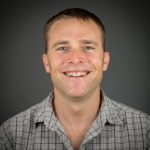
Dr. Nils Peterson, North Carolina State University
June 10 | 11AM ET
View a recording of this presentation.
Webinar Overview:
Since 2011, the Southeast Conservation Adaptation Strategy (SECAS) partnership has pursued its goal of measurably improving the health, function, and connectivity of Southeastern ecosystems. To ensure the partnership’s governance structure facilitates progress toward this vision and goal, the SECAS Steering Committee requested an assessment of the partnership. In this webinar I summarize key insights from the resulting assessment supported by SECAS and the Southeast Climate Adaptation Science Center. The report was based on interviews with SECAS participants and a literature review and case studies focused on identifying best practices for structuring collaborative landscape scale partnerships like those SECAS facilitates. SECAS was considered successful by collaborators who had several recommendations for ensuring success of regional conservation efforts in the future. These recommendations included: developing a succession plan for SECAS leadership, communicating its purpose more broadly within partner organizations, and expanding points of contact within partner organizations. I will conclude by reviewing how these emerging priorities for SECAS fit more broadly within priorities for wildlife management agencies in Southeast.
Learn more about the Speaker:

Dr. Nils Peterson is a Professor of Fisheries, Wildlife, and Conservation Biology at NC State University, and Principal Investigator of the Southeast Climate Adaptation Science Center. His research focuses on unraveling the drivers of environmental behavior, particularly behaviors impacting biodiversity conservation initiatives. Most of his research uses environmental education, environmental conflict, and environmental policy making as natural experiments to test hypotheses about conservation behaviors. For more information about his research program, see his web page or Google scholar profile.
Case Studies of Ecosystem Services Mapping in the Southeast
SE CASC Consortium University Graduate Students and Postdoctoral Scholars
July 20 | 11AM ET
View a recording of this presentation.
Webinar Overview:
Students and postdocs from Consortium universities of the Southeast Climate Adaptation Science Center – North Carolina State University, Auburn University, Duke University, University of Florida, and University of Tennessee – developed case studies utilizing ecosystem services mapping to address issues of relevance to different resources manager and stakeholders in the Southeast. In this webinar, project teams will showcase their work and products using a lightning presentation format.
Presentations include:
- Ecosystem Services and Dis-services from Sea Level Rise-driven Forested Wetland Transition – Melinda Martinez, NC State University
- The Ecosystem Services of Greenspaces: Locating Highly Suitable Communities in Alabama, United States – Mason Pitre, Auburn University
- Building Social Equity into Floodplain Buyouts – Sarah Lipuma, Duke University
- Impacts of Urban Development on Aquifer Ecosystem Services – Shirley Tandoh, University of Florida
- Investigating Associations Between Social Vulnerability and Environmental Quality in the Southeastern United States – Sarah Love, University of Tennessee
Structured Decision Making as a Tool for Coastal Restoration: A Case Study on Ship Island, Mississippi
Dr. Gregory Steyer, USGS Southeast Region
August 17 | 11AM ET
View a recording of this presentation.
Webinar Overview:
Barrier islands protect mainland areas from storm surge, but can erode over time and require restoration. Ship Island, a barrier island off the coast of Mississippi, provides an example of this: the island was battered by Hurricane Camille in 1969 and split into two separate islands. As part of the Mississippi Coastal Improvements Program, the U.S. Army Corps of Engineers planned to use approximately 22 million cubic yards of sand to close the gap between East and West Ship Islands to restore the island’s physical integrity and habitat for important species such as sea turtles, shorebirds, and Gulf Sturgeon, a project that was recently completed. This case study tested the usefulness of structured decision-making – a systematic, formal approach for evaluating options – as a tool for making coastal restoration management decisions. Researchers solicited input from project stakeholders, scientists, and engineers and incorporated this information, along with modeling and quantitative analysis, into a framework to inform decision-making, should the island incur storm damage while the restoration is underway. Ultimately, the structured decision-making process yielded management recommendations that could be quickly and effectively implemented during the Ship Island construction, while helping participants maximize the island’s future resilience. It also led to a general decision framework and process that could be expanded and adapted for use by future barrier island restoration projects.
Learn more about the speaker:

Dr. Greg Steyer is the Gulf of Mexico Science Advisor for the U.S. Geological Survey Southeast Region. Greg coordinates USGS Science in the Gulf of Mexico region on behalf of the bureau and serves as a USGS liaison and technical resource for agencies working on Gulf Coast ecosystem restoration. His research focuses on developing comprehensive monitoring programs, adaptive management approaches, and ecological and landscape models for use in Gulf restoration decision support.