Symposium Resources
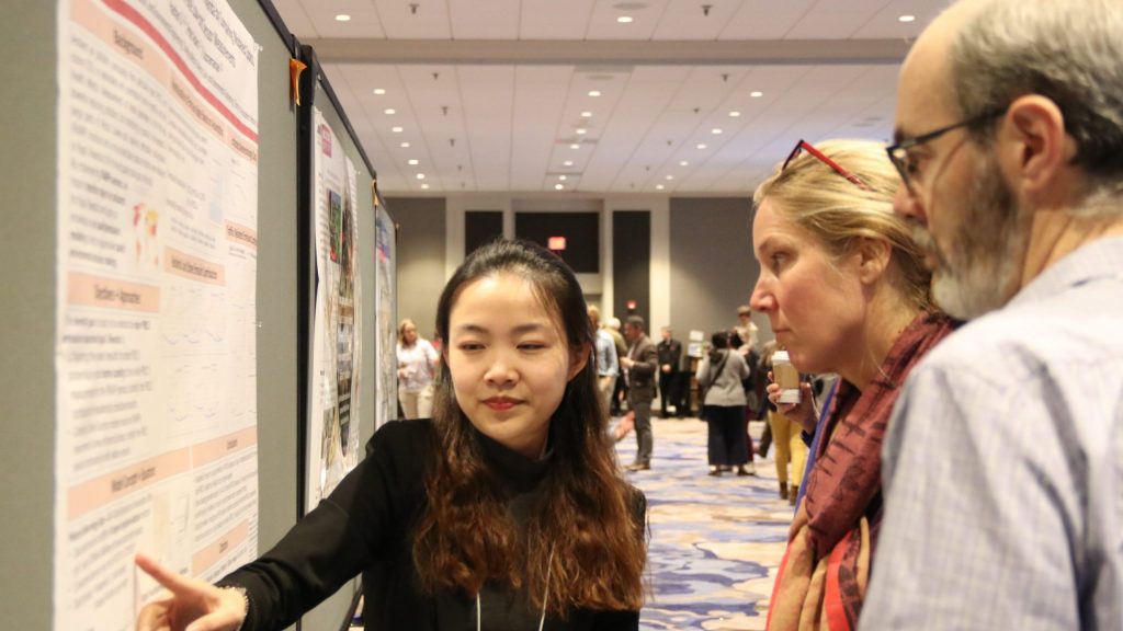
A wide range of new research, posters, tools, and information was shared over the two days of the Regional Science Symposium. You can find project descriptions, as well as related links and resources, for the World Cafe Session, and the Poster and Tools Networking Session throughout this page.
Tools Resources
Tools shared during the Poster and Tools Networking session demonstrated new resources to help stakeholders interpret and apply science information.
Fire Weather Intelligence Portal
undefinedA real-time monitoring tool for weather and fire risk information to help plan prescribed burns, analyze historical conditions affecting burn success, and track environmental indicators of drought and fire danger. Provides easy access to past, current, and short-term forecast conditions for a variety of weather parameters. Learn More
The Gulf Coast Conservation Prioritization Tool (CPT)
The Conservation Prioritization Tool (CPT) enables users to evaluate a proposed conservation project or suite of projects. This tool is relevant to the broad land conservation community, including land trusts, federal and state agencies,NGOs and private industry.undefined Learn More
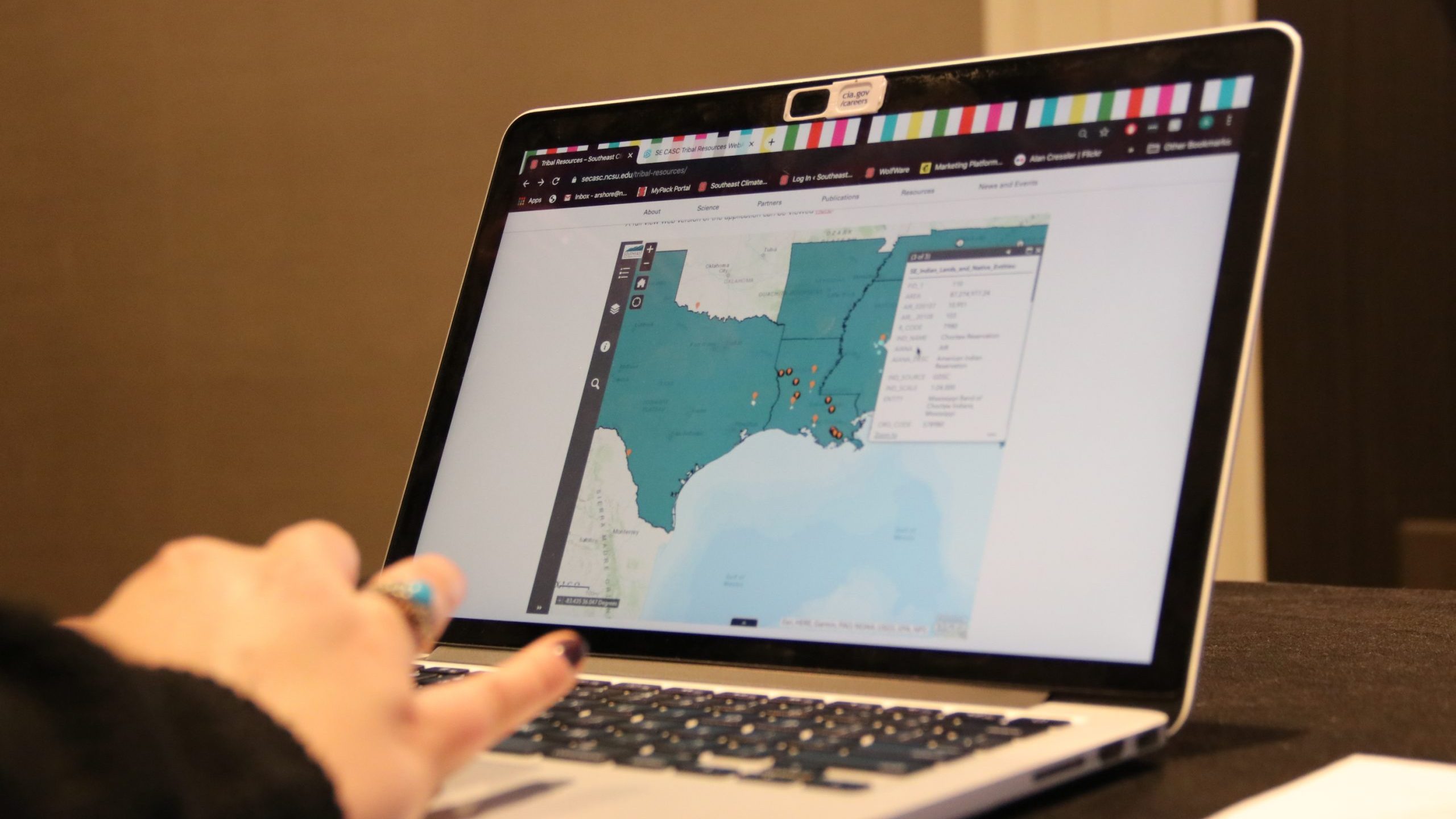
Tribal Resources Web App
The Tribal Resources Web App is aundefinedweb-based platform that hosts climate adaptation resources and general resources for, and about, Federally and State Recognized Tribes as well as geographic information and web links to connect users with Tribes’ web pages. Learn More.
The Florida Conservation Planning Atlas (CPA)
The Florida Conservation Planning Atlas is a data discovery, visualization, and analytical platform for stakeholders throughout Florida to increase collaboration. Tools found on the atlas include Climate Adaptation Explorer, Conservation Actions Tracker, Fire Map Viewer, Simple Map Viewer and Advanced Mapper. Learn More.
Ecosystem Services Maps
The Ecosystem services map products for wild pollination, recreational birding, and open space access, are now available for download. Products include regional priority areas at the county and watershed levels as well as underlying information that enables users to refine the prioritization for specific areas of interest. Learn More.
Forests After Florence
The Forests after Florence project maps the path of Hurricane Florence and its impact on urban forests, coastal communities and NCSU students. Learn More.
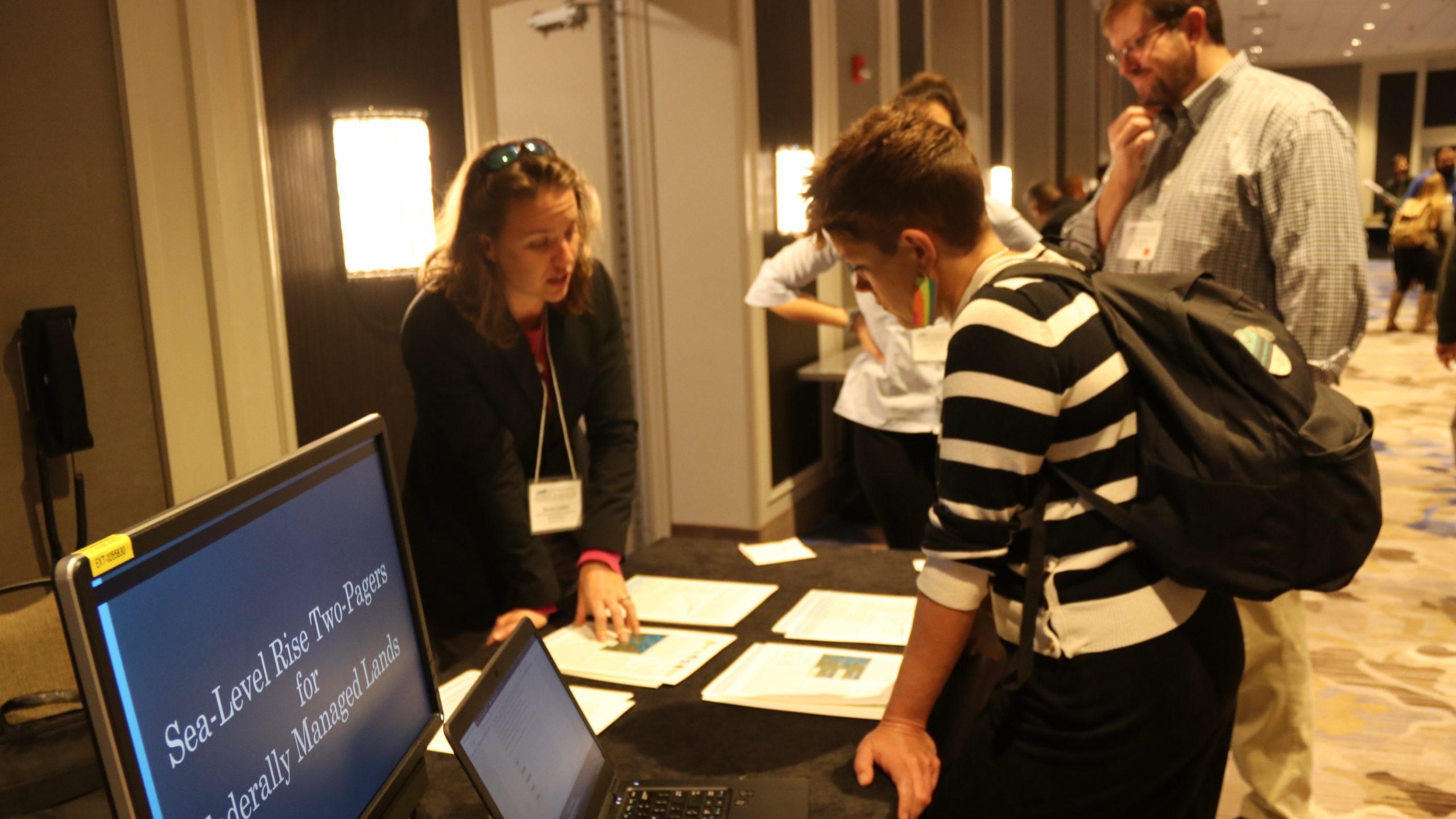
Sea Level Rise Fact Sheets
Downloadable files allow users to develop customized fact sheets that describe local sea level rise scenarios and potential impacts at specific locations in the northern Gulf of Mexico. Fact sheets have been developed for each of the federally managed lands in the area, as part of SE CASC project, New Sea Level Rise Fact Sheets for Federal Lands in Northern Gulf of Mexico, and are available in SE CASC Resources. Learn more.
Poster Resources
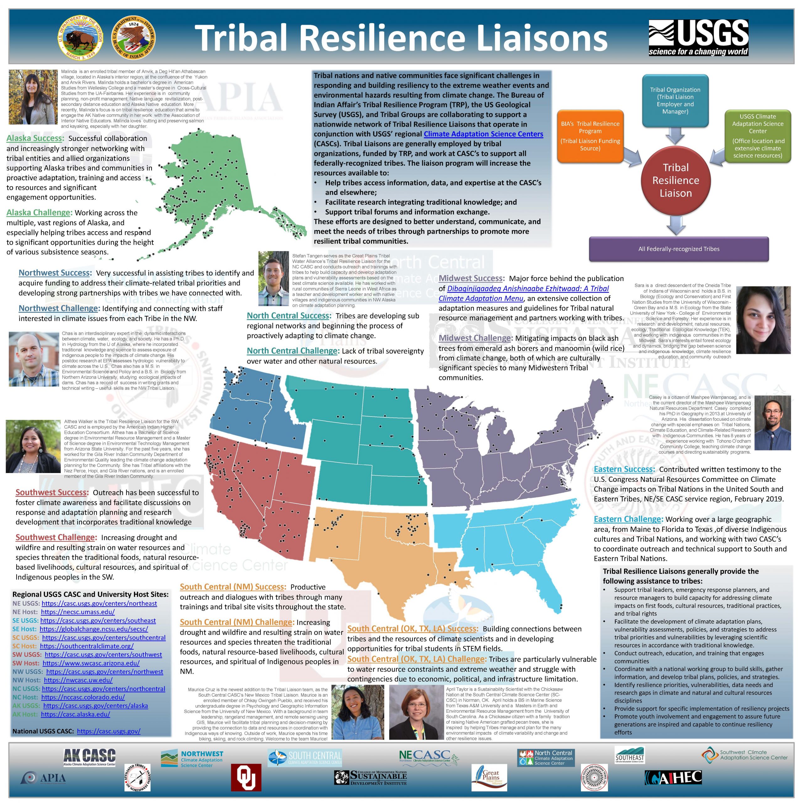
Tribal Partners: Tribal Resilience Liaisons
Learn more.
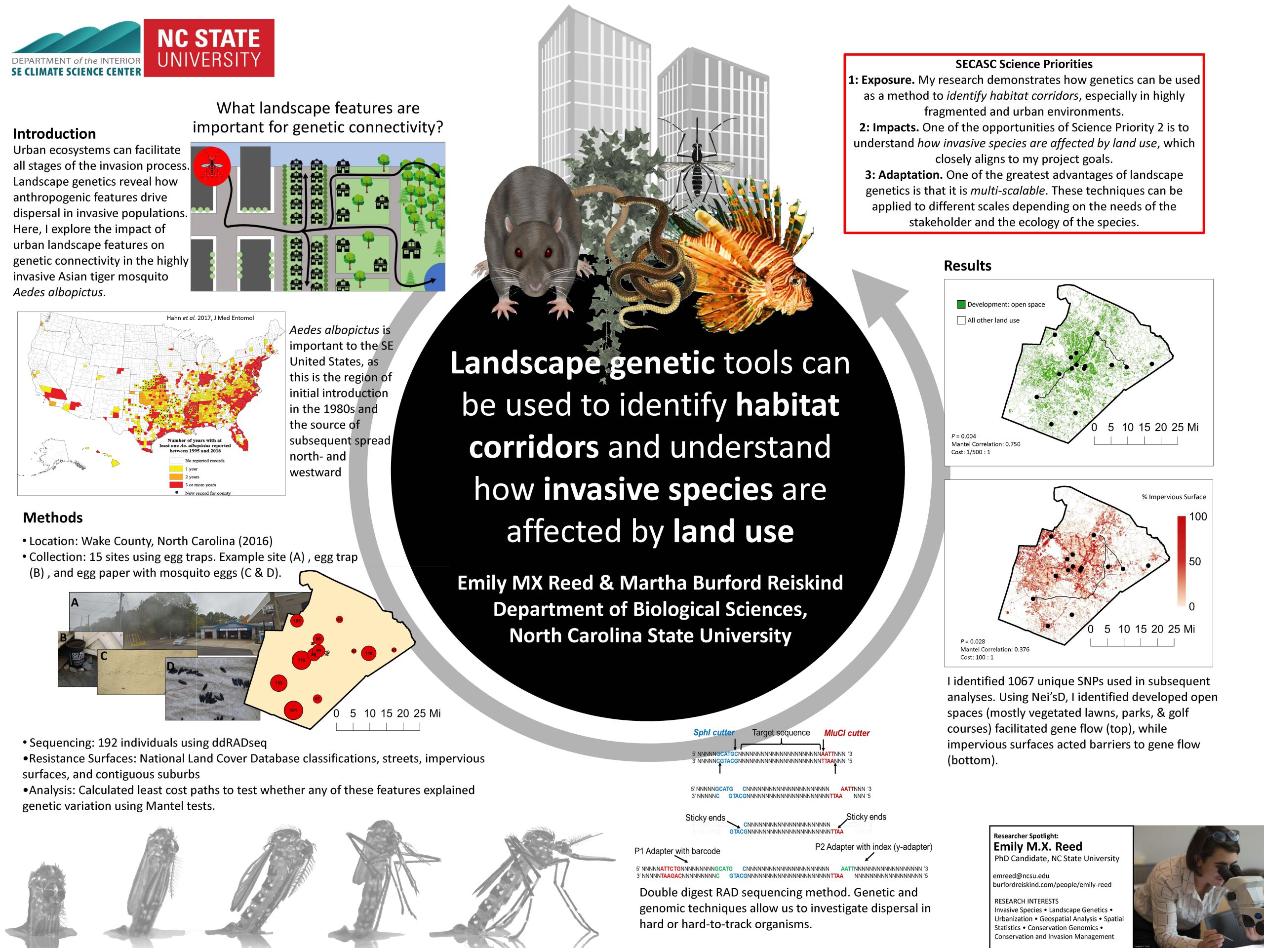
Invasive Species: Landscape Genetics of an Invasive Species in an Urban-Rural Landscape
Learn more.
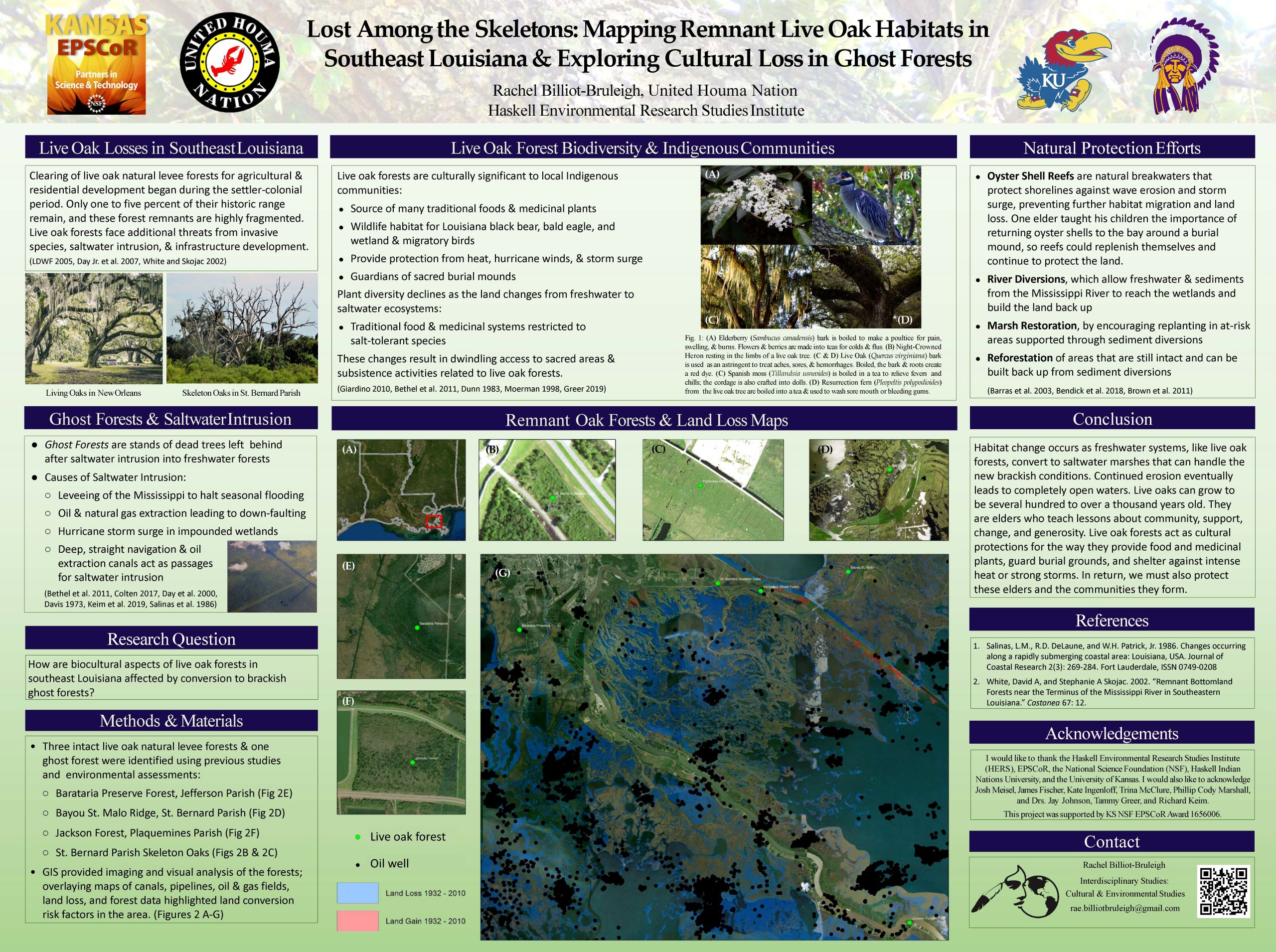
Saltwater Intrusion: Lost Amongst the Skeletons
Learn more.
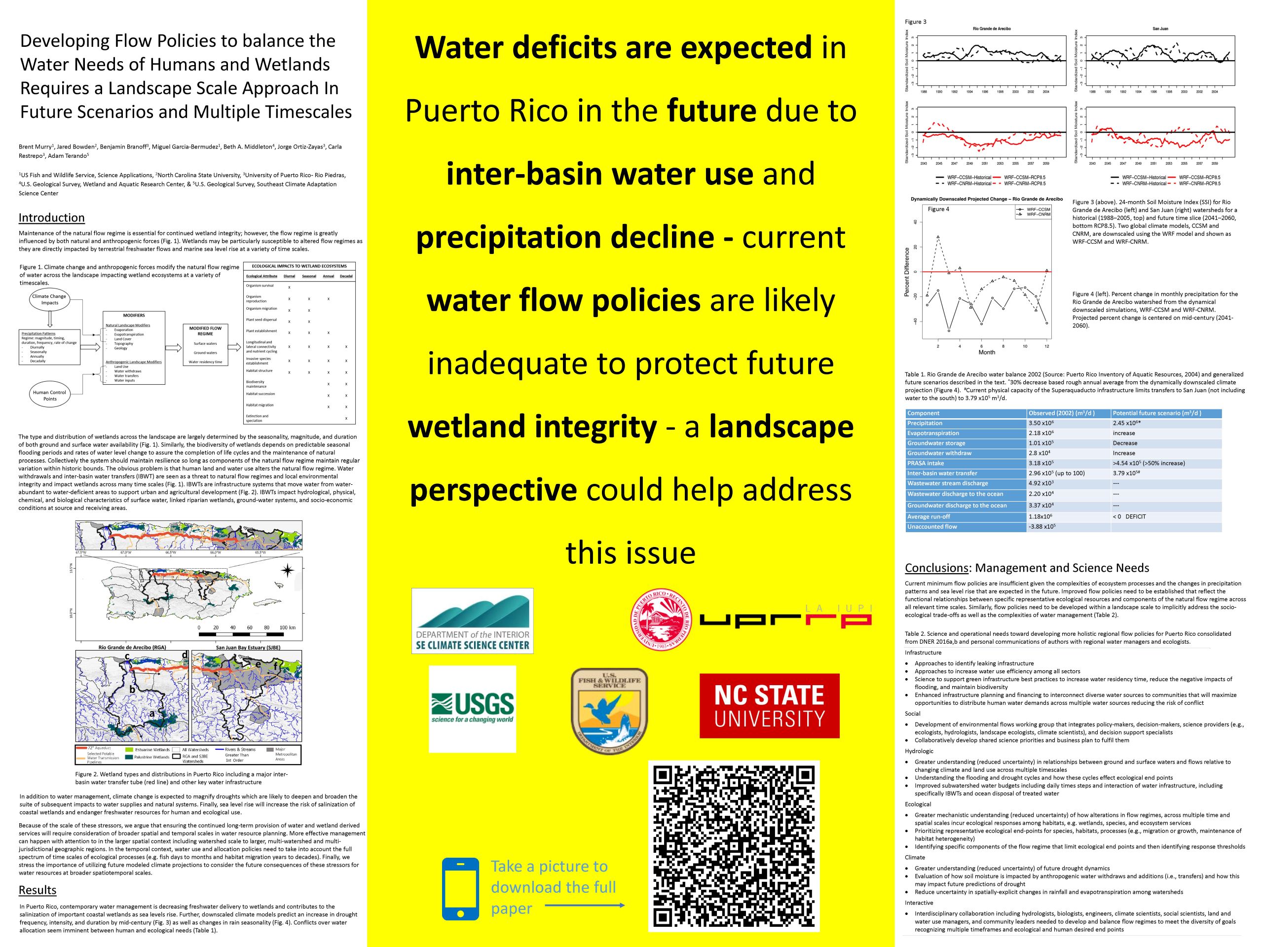
Flow Policies: Developing flow policies to balance the water needs of humans and wetlands requires a landscape scale approach inclusive of future scenarios and multiple timescales
Learn more.
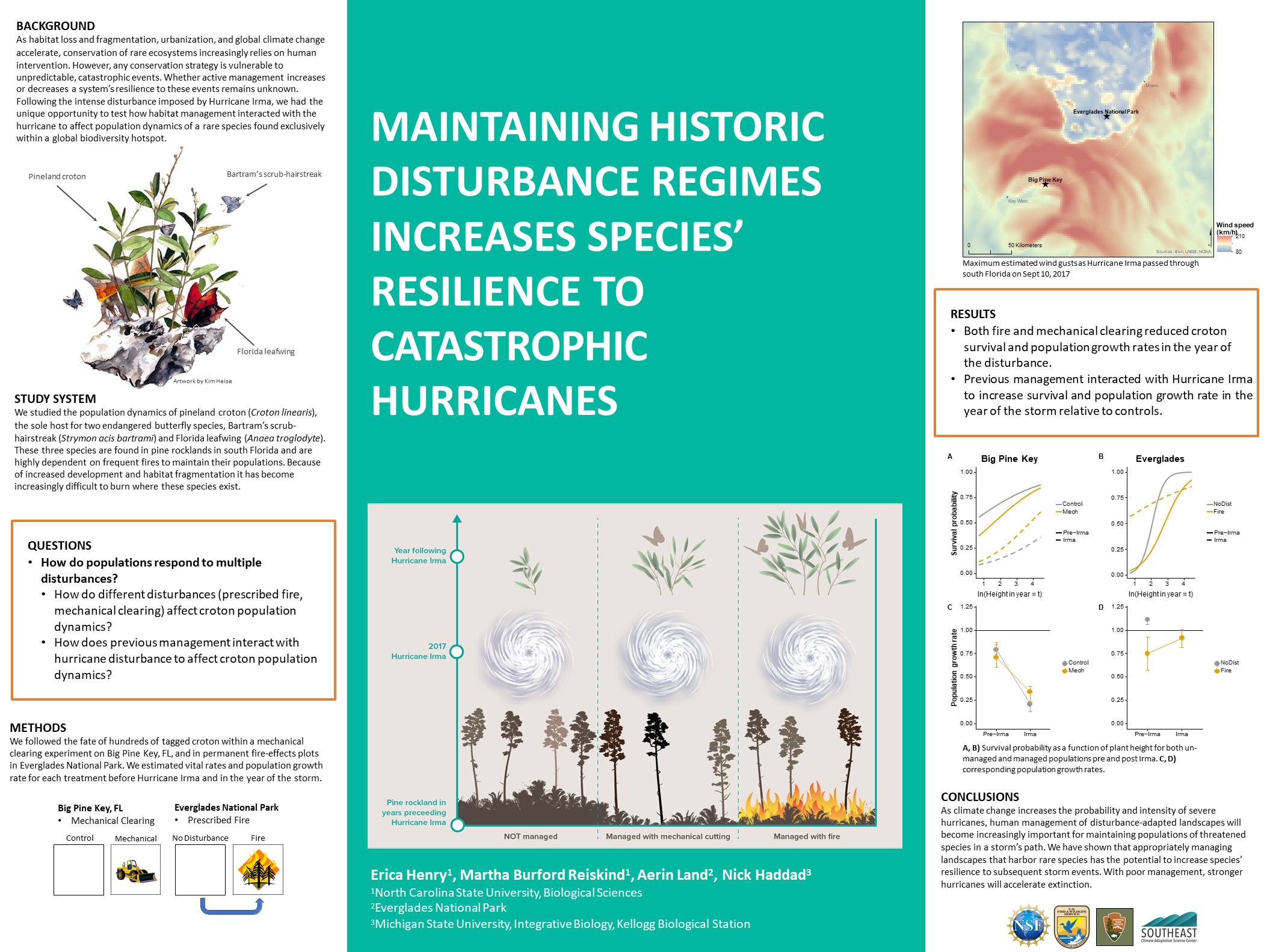
Endangered Butterflies: Maintaining Historic Disturbance Regimes Increases Species’ Resilience to Catastrophic Hurricanes
Learn more
POSTER PDFs
- Tribal Resilience Liaisons; Casey Thornbrugh
- Landscape Genetics of an Invasive Species in an Urban-Rural Landscape; Emily Reed
- Mapping the potential for live oak ghost forests in Southeast Louisiana & exploring cultural losses; Rachel Billiot-Bruleigh
- Developing flow policies to balance the water needs of humans and wetlands requires a landscape scale approach inclusive of future scenarios and multiple timescales; Brent Murry
- Maintaining Historic Disturbance Regimes Increases Species’ Resilience to Catastrophic Hurricanes; Erica Henry
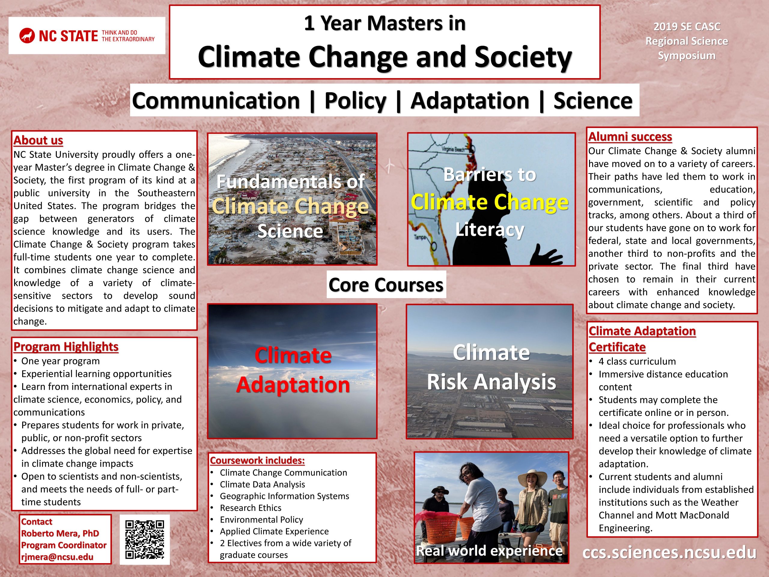
CCS Program: Climate Change and Society Program
Learn more
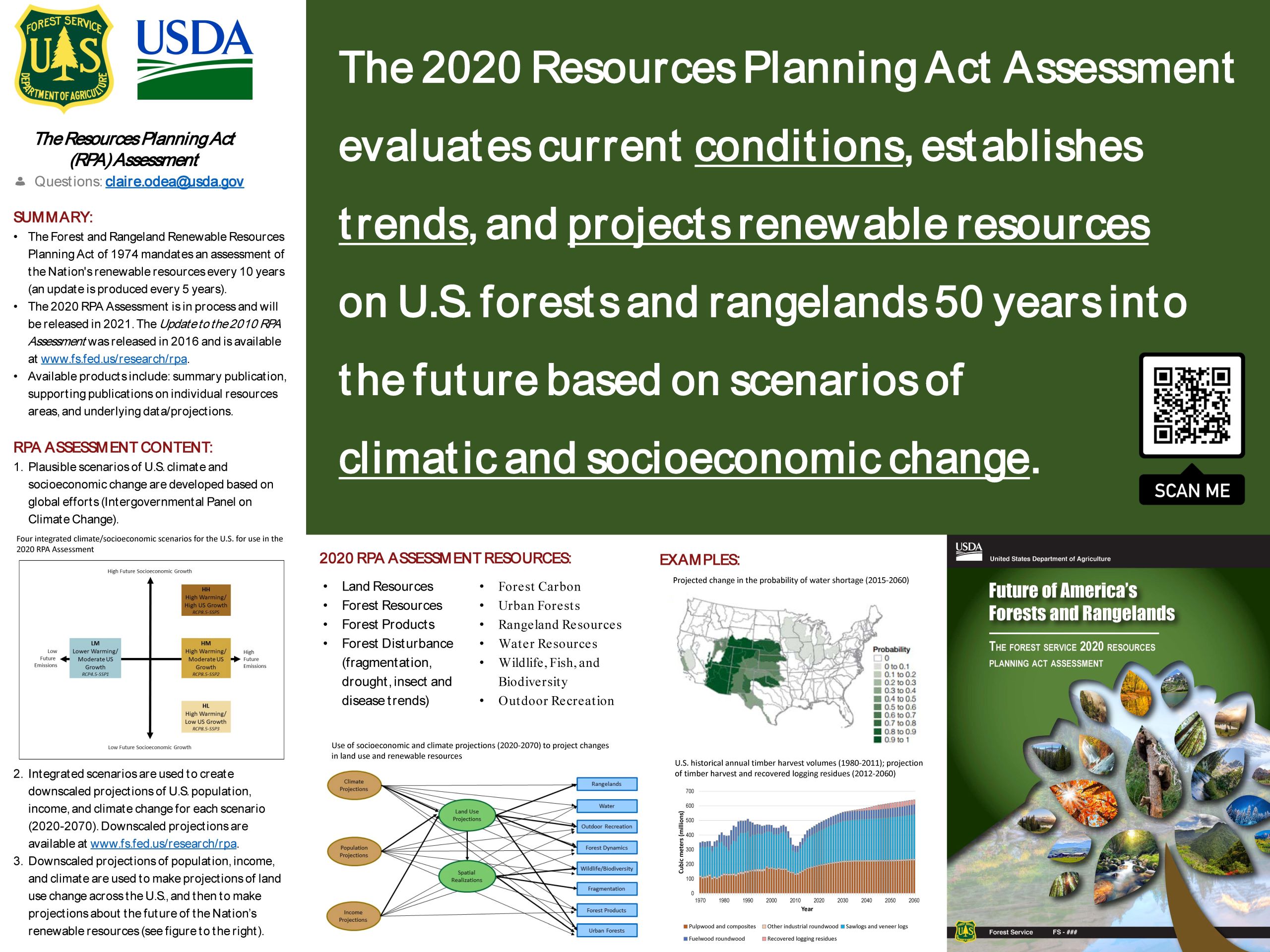
RPA Assessment: The Future of America’s Forests and Rangelands: An Overview of the Resources Planning Act Assessment
Learn more
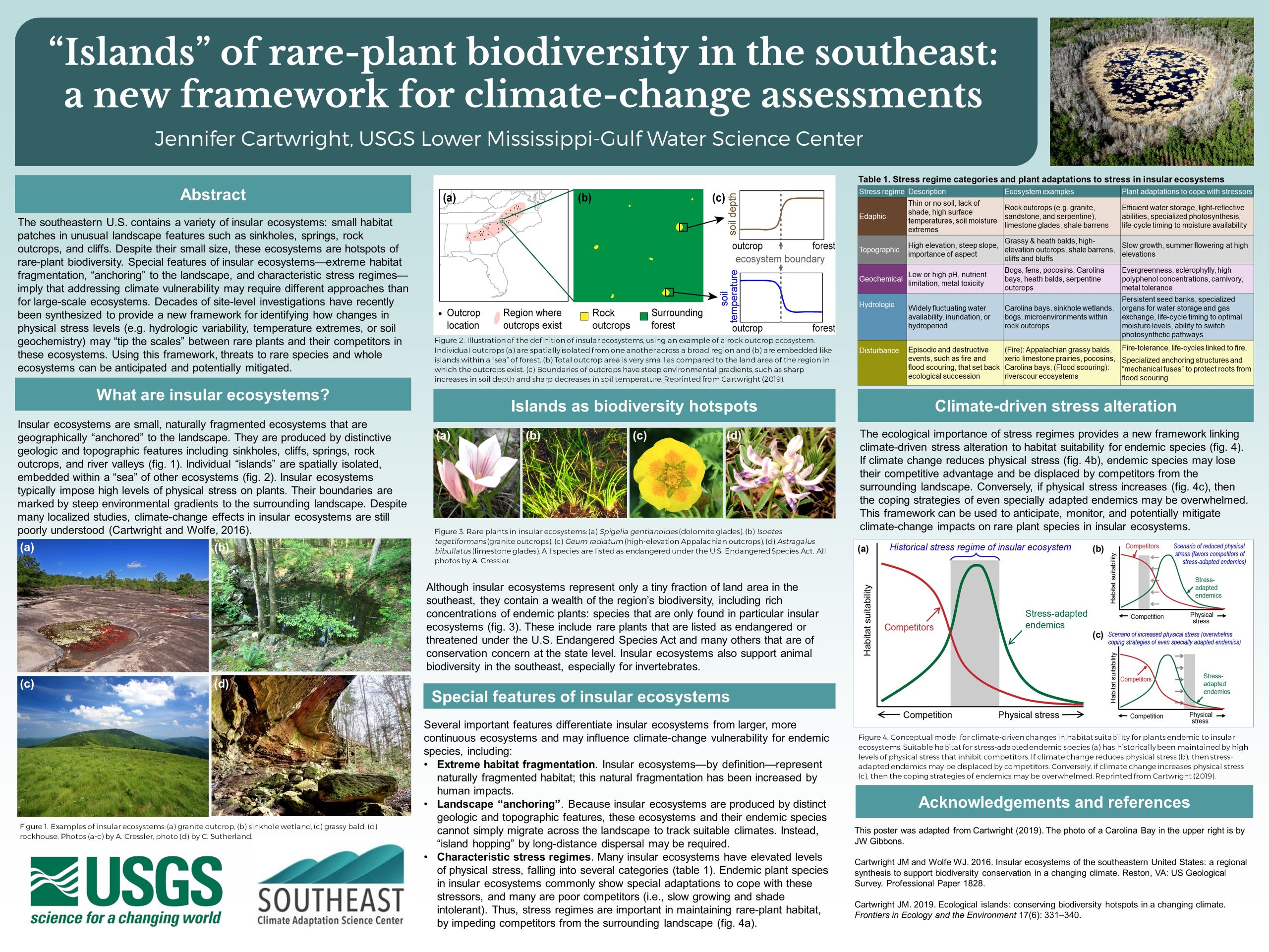
Rare Plant Islands: Islands of rare-plant biodiversity in the southeast: new approaches for climate-change assessments
Learn more
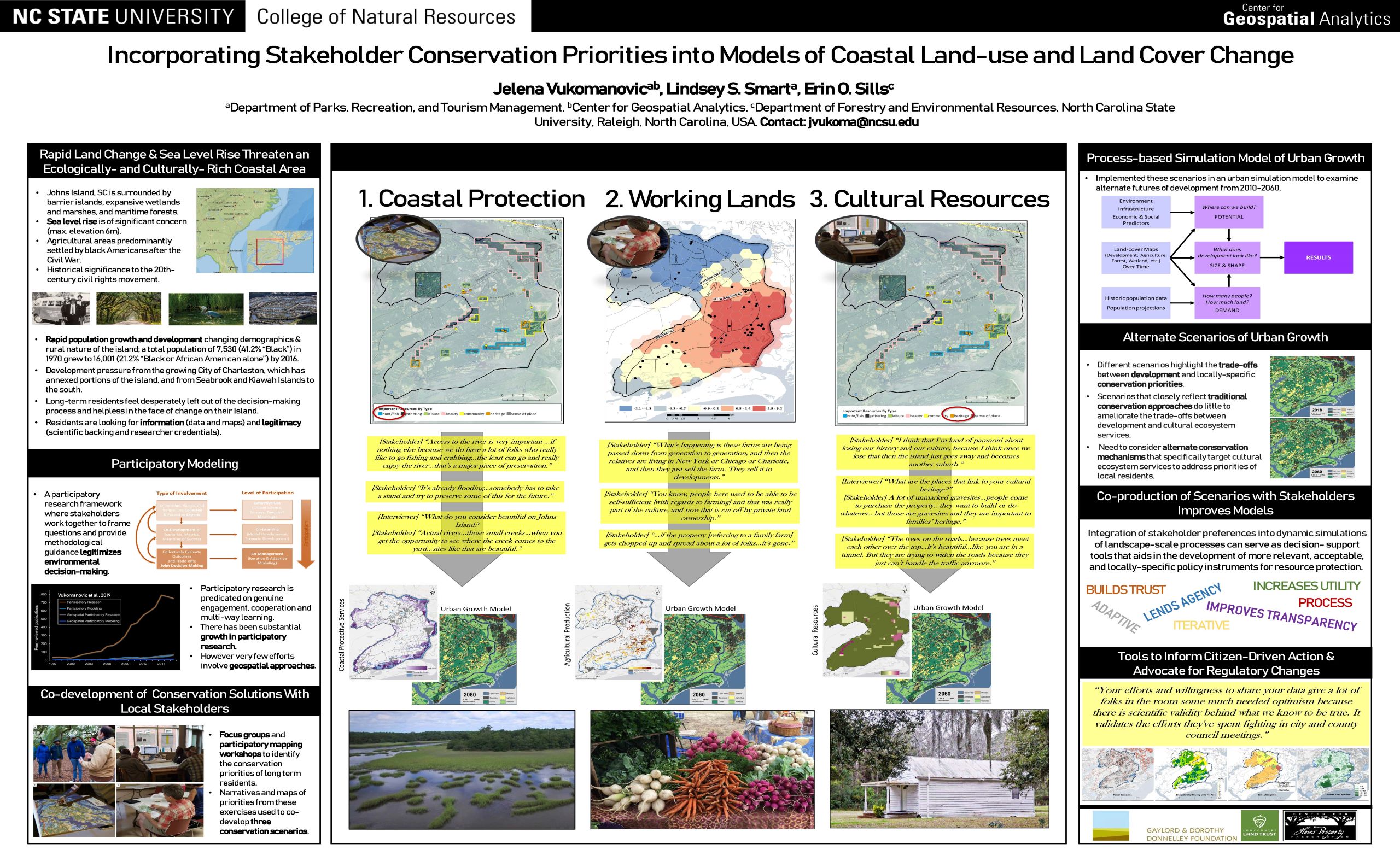
Conservation Priorities: Incorporating Stakeholder-Derived Conservation Priorities into Models of Coastal Land-use and Land Cover Change
Learn more
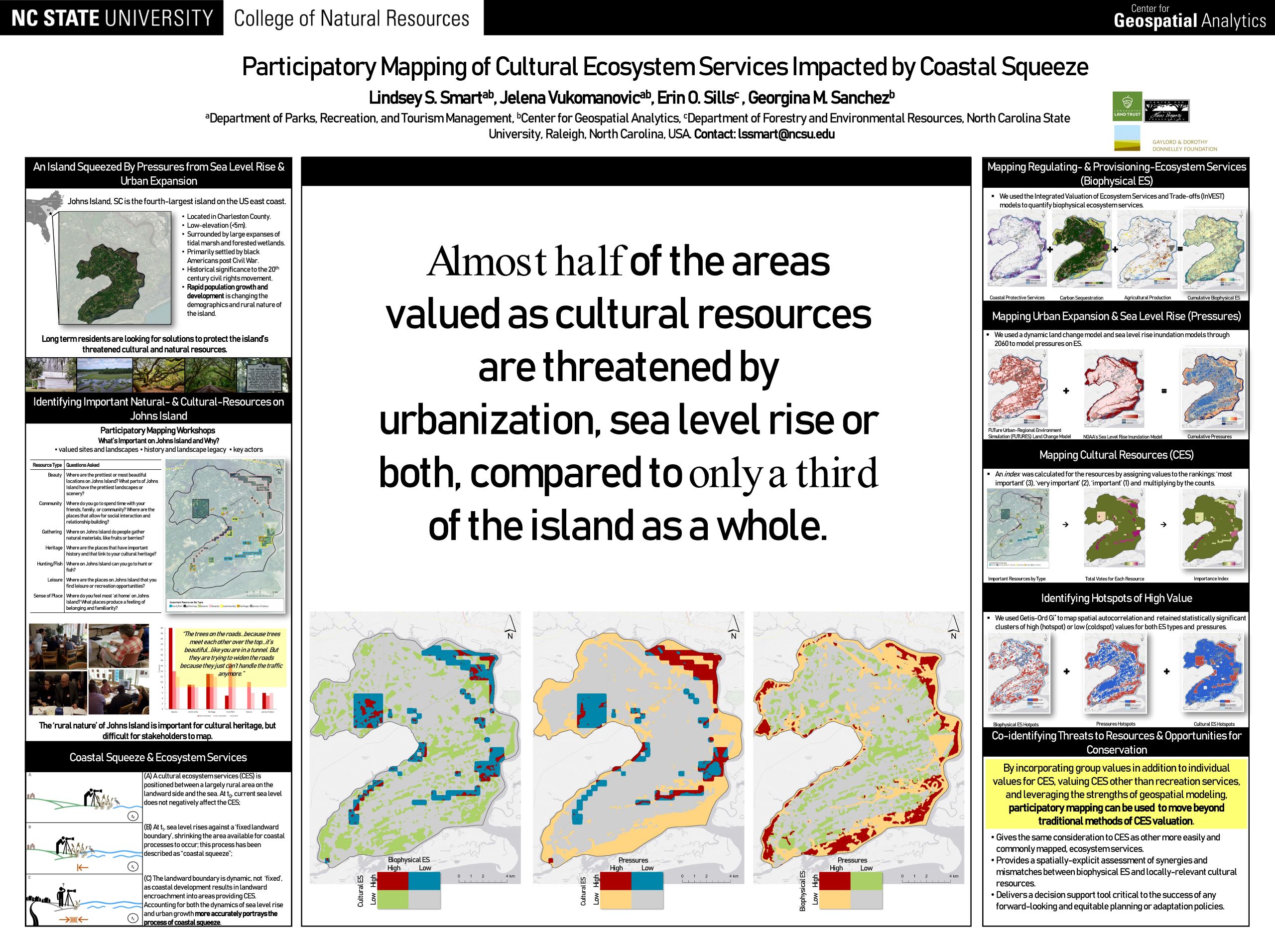
Coastal Squeeze: Participatory Mapping of Cultural Ecosystem Services Impacted by Coastal Squeeze
Learn more
POSTER PDF’s
- Climate Change and Society Program; Roberto Mera
- Resource Planning Act Assessment; Jennifer Costanza
- Islands of rare-plant biodiversity in the southeast: new approaches for climate-change assessments; Jennifer Cartwright
- Incorporating Stakeholder-Derived Conservation Priorities into Models of Coastal Land-use and Land Cover Change; Jelena Vukomanovic
- Participatory Mapping of Cultural Ecosystem Services Impacted by Coastal Squeeze; Lindsey Smart
World Cafe Resources
The World Cafe Session consisted of organizational tables and topical tables. Organizational tables provided resources and discussion for stakeholders about management and research partner organizations, while topical tables conducted focused discussions on specific topics related to actionable science research and outcomes.
Organizational Tables
RESTORE Council
The RESTORE Council was established out of the RESTORE Act, which is a regional approach to restoring the long-term health of the Gulf Coast Region. The council includes Governors from the states of Alabama, Florida, Louisiana, Mississippi, and Texas, as well as Secretaries of the US Departments of Agriculture, the Army, Commerce, Homeland Security, the Interior and the Administrator of US EPA. Learn More about their conservation plans and restoration partners.
NOAA Consortium
undefinedThe NOAA Consortium is a federal/state partnership that matches NOAA Sea Grant expertise and resources with state academic institutions. Their mission is to provide integrated university and college-based research, communications, education, extension and legal programs to coastal communities that lead to the responsible use of ocean and coastalundefined resources in Alabama and Mississippi and the Gulf of Mexico through informed personal, policy and management decisions. Learn more about NOAA Consortium’s partners, projects and current opportunities.
American Society of Adaptation Professionals
The American Society of Adaptation Professionals is a 501(c)3 Nonprofit Organization that aims to support and connect climate adaptation professionals to advance innovation in the field of practice. Learn more about their partnerships and opportunities.
Southern Climate Impacts Planning Program
The Southern Climate Impacts Planning Program is a south central focused climate hazards and research program whose mission is to increase the region’s resiliency and level of preparedness for weather extremes. The area served includes the region of Oklahoma, Texas, Arkansas, Louisiana, Tennessee, and Mississippi. From severe storms, flooding, drought, hurricanes and storm surge, heat waves, wildfires, to winter storms, the South experiences among the nation’s most extensive collection of climate-related hazards with many southern states ranking at or near the top of the lists in disaster declarations and billion dollar disasters. Learn moreabout SCIPP projects and opportunities.
USDA Southeast Climate Hub
undefinedThe Southeast Climate Hub connects public, academic, and private sector organizations with researchers and outreach specialists to deliver technical support and provide tools that help producers cope with challenges associated with drought, heat stress, excessive moisture, changes in pest pressures. The Southeast Hub works to maintain and strengthen agricultural production, natural resource management, and rural economic development under increasing climate variability. Learn More about their current projects.
Southeast Regional Partnership for Planning and Sustainability
The Southeast Regional Partnership for Planning and Sustainability is a six-state partnership comprised of state and federal agencies promoting collaboration in making resource-use decisions supporting national defense, conservation of natural resources, and sustainable working lands and communities in the Southeast US. Learn More about their projects and resources.
Topical Tables
Evaluation of Adaptation Science and Management Focus Groups
Are you a natural or cultural resource manager who considers climate science information in your management decisions? Natural and cultural resource managers, researchers and coordinators came together to discuss and provide input on what information, products and outcomes are most useful to stakeholders when considering CASC science projects.
Social Science Idea Generators
Interested in addressing coastal resilience with social scientists? Idea generator tables hosted discussions with SE CASC stakeholders to explore how social science research can help inform coastal resilience challenges and decision making. Participants brought specific issues to the table to generate important social science research questions and discussions about interdisciplinary approaches to coastal resilience.
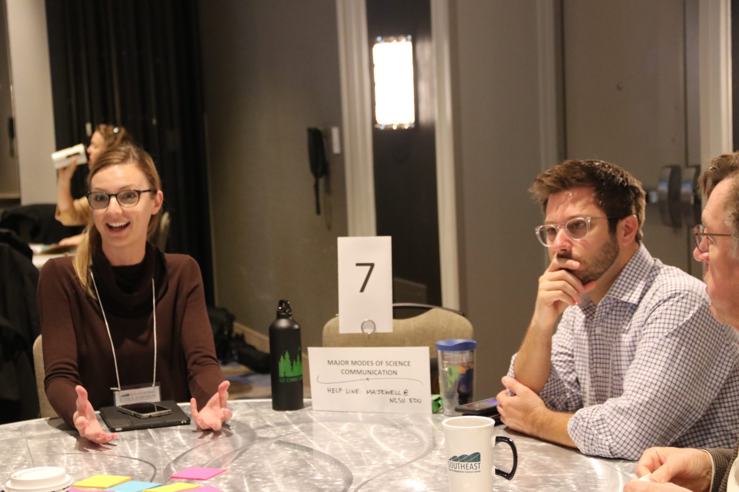
Major Modes of Science Communication
What ways have you used to communicate your science results? Participants discussed methods previously used to communicate scientific results and brainstormed new ways to effectively communicate their findings to their target audiences through examples and resources.